
 In
a new
book,
historian
Robert
Grenville
explores
the
haunting
beauty
of
nature
reclaiming
some of
history’s
most
notorious
sites
In
a new
book,
historian
Robert
Grenville
explores
the
haunting
beauty
of
nature
reclaiming
some of
history’s
most
notorious
sites
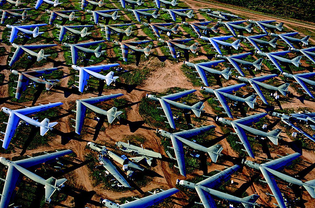
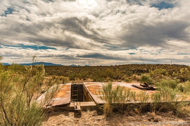
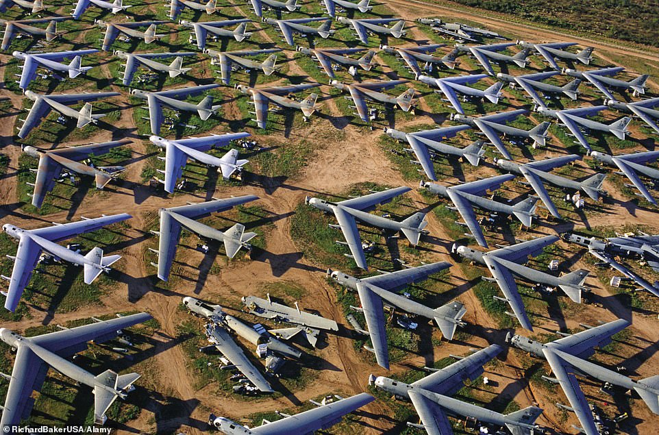
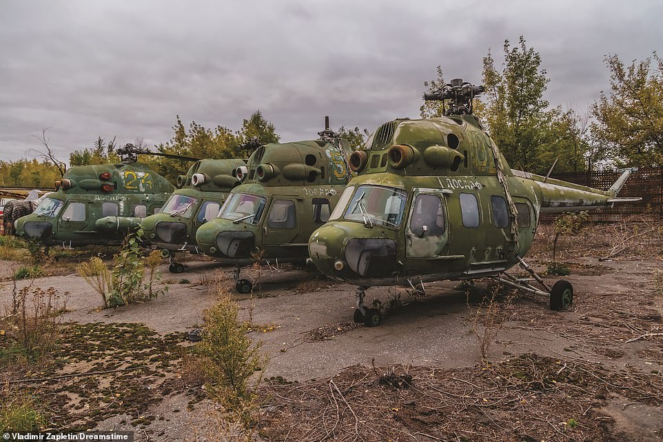
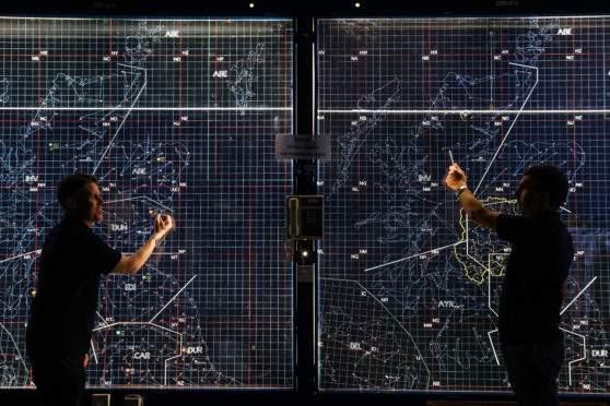
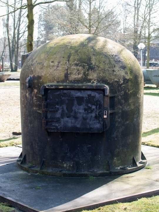
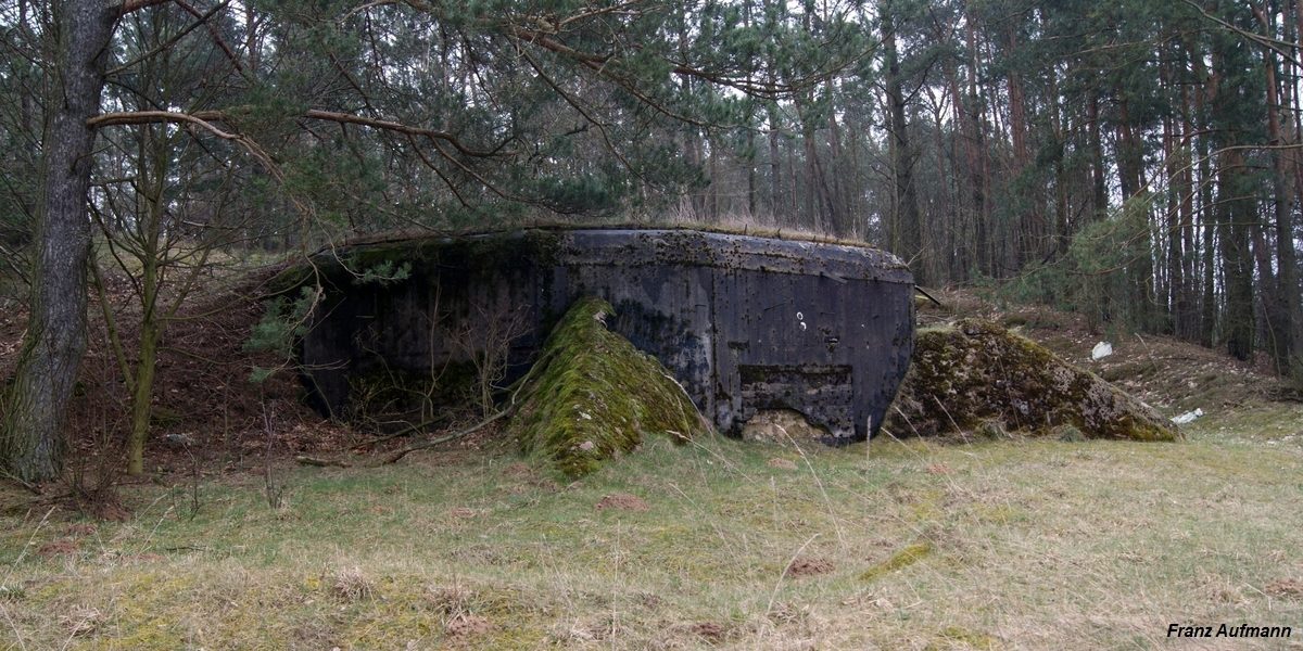
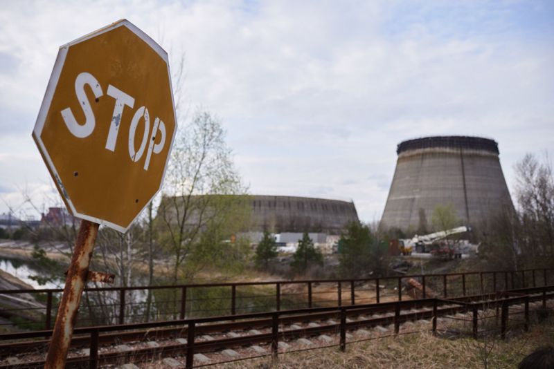
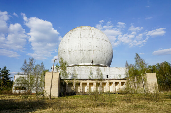
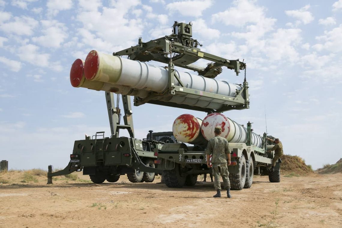
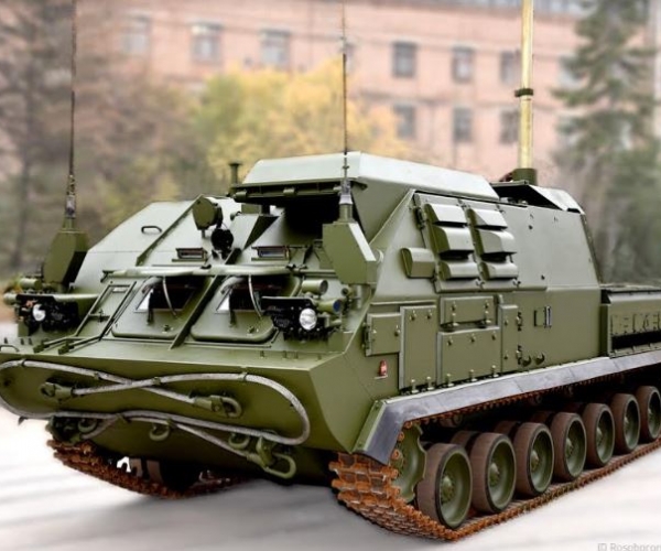
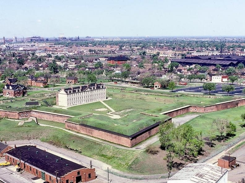
B-52 area storage, Davis-Monthan AFB, Tucson, Arizona, USA
By Jennifer Billock smithsonianmag.com
The Cold
War, or
the “war
that
wasn’t,”
lasted
from
1947 to
1991.
The two
main
powers,
the
United
States
and the
USSR,
never
actually
attacked
each
other—instead,
they
flexed
their
muscles
to
intimidate
one
another,
causing
events
like the
arms
race and
the
space
race,
and
spurring
proxy
wars
like the
Vietnam
War and
the
Korean
War.
Nevertheless,
the two
countries
prepared
themselves
for an
eventual
battle,
one that
never
happened.
Historian
and
author
Robert
Grenville
has
immortalized
some
now-deserted
sites of
the
conflict
in his
new
book,
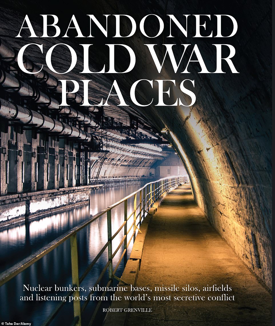
Abandoned
Cold War
Places.
In it,
he
compiles
photographs
of
places
built
for or
touched
by the
war,
like an
aircraft
graveyard
and
decaying
military
housing.
“The
book is
a
curated
tour of
the
detritus
left
behind
by both
sides
around
the
world
during
the Cold
War—almost
half of
the
twentieth
century,”
Grenville
says.
“The
idea was
to
convey
an
impression
of the
scale of
the
confrontation
and the
legacy
that
endures
to this
day.”
Smithsonian
magazine
interviewed
Grenville
about
the
book,
the most
striking
places
and
images,
and the
tendency
for
sites
like
these to
become
tourist
attractions.
What was your motivation for creating this book?
I wanted to look at the physical legacy of the stand-off between these two power blocs. I grew up during the last few decades of the Cold War and that had a great impact on me. I remember seeing the pagodas in the misty distance at Orford Ness on England’s east coast and wondering what might be taking place inside.
What is it like to visit Cold War sites?
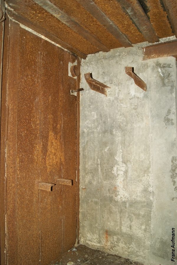
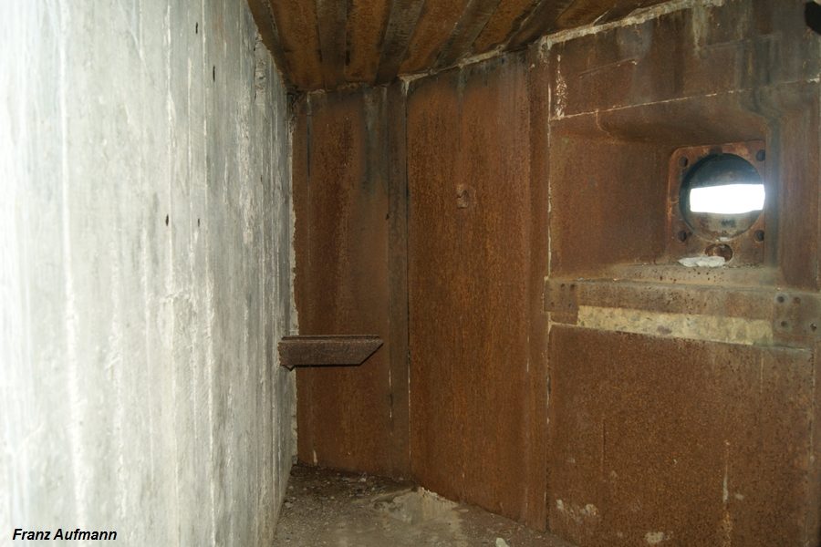
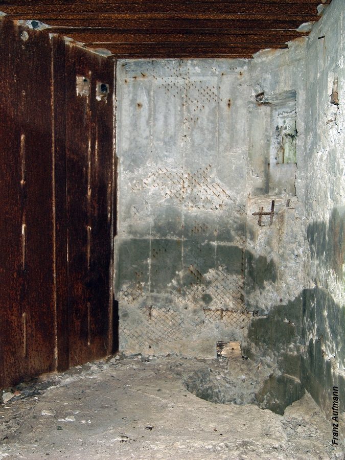
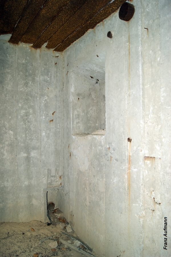
Cold War sites I’ve visited always have a certain atmosphere, a sense of the history that possesses even the most ordinary objects. With some of the less accessible sites, you get the strong sense that someone has just left the room to make coffee, and could at any moment walk back through the door. They are like time capsules. A good example is the image in the book showing a 1981 Russian newspaper pinned to a door, describing the events in the Soviet Congress that mentioned Mikhail Gorbachev. It is something to think about who might have pinned that up, and why. Where might they be now?
 Abandoned
Cold War
Places:
Nuclear
Bunkers,
Submarine
Bases,
Missile
Silos,
Airfields
and
Listening
Posts
from the
World's
Most
Secretive
Conflict
Abandoned
Cold War
Places:
Nuclear
Bunkers,
Submarine
Bases,
Missile
Silos,
Airfields
and
Listening
Posts
from the
World's
Most
Secretive
Conflict
On the 30th anniversary of the fall of the Berlin Wall, this fascinating visual history explores the relics abandoned when the Cold War ended.
In your opinion, what is the most interesting site in the book?
I find the bunker built for President Kennedy on Peanut Island in Florida to be fascinating. It was there for use if war was declared while he was at Palm Beach with his family. It’s believed that he never visited before his assassination, but the Presidential seal still sits on the floor ready for his arrival, even though the bunker is now decommissioned and declassified.
Could you share some of the compelling stories behind the sites?
I’ve
always
been
fascinated
by what
happens
to
aircraft
when
they
reach
their
end of
life,
and the
U.S. Air
Force
has
stored
obsolete
aircraft
for
years in
perfect
dry
conditions
in the
Arizona
desert
that
keeps
the
aircraft
looking
ready to
fly. The
fact
that the
U.S.
recently
rescued
a former
B-52
bomber
from
this
scrapyard
and
brought
it back
into
active
service—after
it had
been
flown
originally
for some
50 years—is
incredible.
In
theory,
some
modern
U.S.
bomber
pilots
could be
flying
the same
actual
aircraft
their
grandfathers
flew,
albeit
much
updated.
Another
favorite
of mine
is the
bunker
built at
the
Greenbrier
Hotel in
White
Sulphur
Springs
for the
House of
Representatives.
It stood
ready
for 30
years,
for
which
the U.S.
government
paid the
hotel a
rent of
$25,000
a year,
until a
Washington
Post
journalist
stumbled
upon its
existence
in 1992
and it
had to
be
decommissioned.
Some of
the
sites
featured
are now
not
abandoned,
but have
been
repurposed,
such as
the
former
base at
RAF
Upper
Heyford
in
England
used for
shooting
Hollywood
films.
Wonder
Woman
was
filmed
there,
for
example.
Others
will
necessarily
remain
without
human
habitation
for some
time,
ike
Pripyat,
near
Chernobyl,
and the
nuclear
testing
area in
Kazakhstan
that is
especially
haunting,
where so
many
test
devices
were
exploded
over the
years
that the
local
population
was
badly
affected
by
radiation
poisoning.
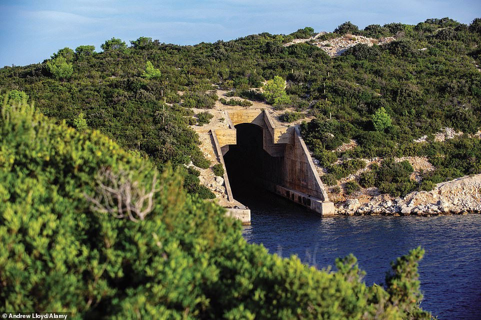
Some of
the
sites—a
former
naval
base on
Russia's
Pacific
coast
and a
small
Croatian
island
dotted
with
subarine
pens and
nuclear
bunkers—have
become
tourist
attractions.
How do
you feel
about
that?
If
presented
in the
right
way, I
welcome
it. It’s
important
for this
part of
our
history
not to
be
forgotten.
A prime
example
is the
various
sites in
Vietnam
associated
with the
war
there.
The
visitors
they
attract
learn
about
the war
from the
Vietnamese
perspective,
and the
sites’
accessibility
encourages
tourism
to that
part of
the
world.
Why is it important for people to know this history and see these photos?
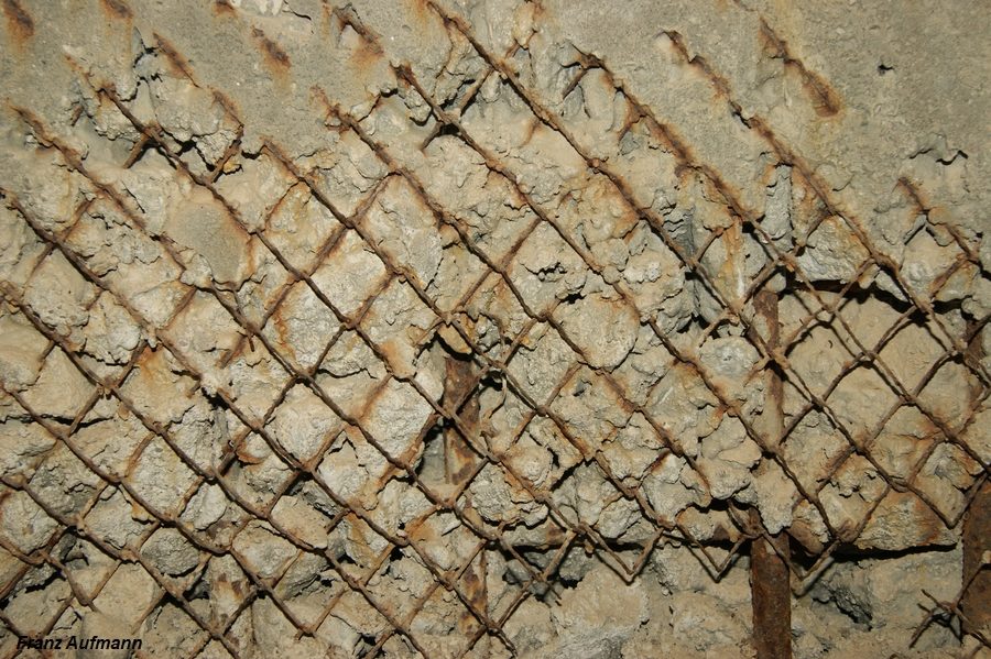
It’s important to grasp the sheer scale of the Cold War and how far it reached around the globe. It certainly surprised me in working on this book. There’s a rusting tank on a beach in Yemen surrounded by goats, while in another section of the book, you see former U.S. radar buildings sinking into the Arctic ice in Greenland. But, for me, the images themselves have this special kind of beauty, seeing the decay that nature has wrought on these once-immaculate, sophisticated systems and installations.
What is the single biggest takeaway readers should get from the book?
Recent events have raised old, familiar tensions between the great world powers, even if those powers are no longer the same as they were 30 years ago. Most young people have not had to live in the shadow of an immediate threat of nuclear war, and the events of that era, such as the Cuban Missile Crisis, serve as a warning to today’s leaders that a false step can quickly lead to potential catastrophe. I hope that readers might be inspired by the book to pursue their interest in the Cold War further—it is such a fascinating period of history that shaped much of our world today.
All images taken from the book Abandoned Cold War Places by Robert Grenville (ISBN 978- 1-78274-917-2) published by Amber Books Ltd (www.amberbooks.co.uk) and available from bookshops and online booksellers (RRP $29.95).


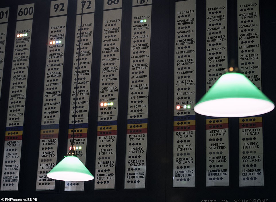
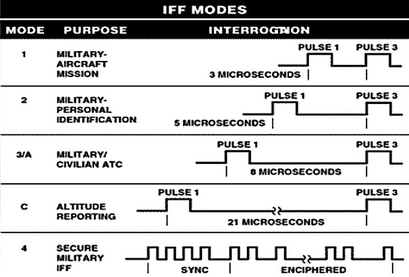 A
chart
showing
details
about
the
capabilities
of the
different
IFF
modes
and the
time it
takes
for them
to
successfully
interrogate
a
target.
Mode 1,
for
instance,
is fast,
but it
only
gives
the
interrogator
information
about
basic
aircraft
type and
whatever
its "mission"
is
according
to how
the
transponder
is
programmed.
The
delay
between
the IFF
system
issuing
a "challenge"
pulse
and when
the
transponder
pulses
its "replies"
is fixed,
as well,
making
it more
vulnerable
to false
signals.
Mode 4
incorporates
a
variable
delay
between
the
pulses
that is
based on
the
encrypted
code the
interrogator
sends
out.
A
chart
showing
details
about
the
capabilities
of the
different
IFF
modes
and the
time it
takes
for them
to
successfully
interrogate
a
target.
Mode 1,
for
instance,
is fast,
but it
only
gives
the
interrogator
information
about
basic
aircraft
type and
whatever
its "mission"
is
according
to how
the
transponder
is
programmed.
The
delay
between
the IFF
system
issuing
a "challenge"
pulse
and when
the
transponder
pulses
its "replies"
is fixed,
as well,
making
it more
vulnerable
to false
signals.
Mode 4
incorporates
a
variable
delay
between
the
pulses
that is
based on
the
encrypted
code the
interrogator
sends
out.


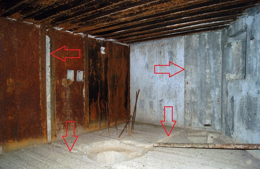
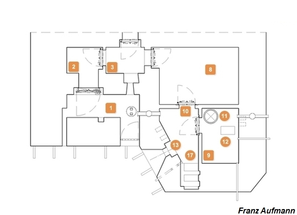
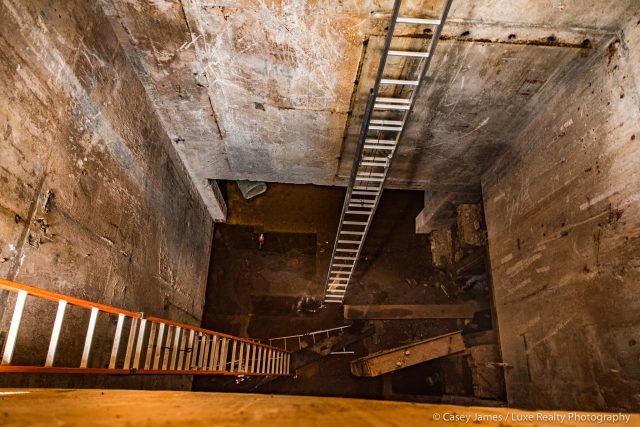 Ladders
leading from the surface down to the silo.
Ladders
leading from the surface down to the silo. 


 L'occupation
militaire
se
durcit
L'occupation
militaire
se
durcit
 Ŕ
l’intérieur
des
bunkers
Ŕ
l’intérieur
des
bunkers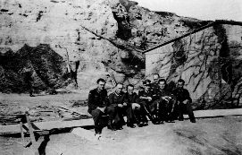 La
716e
division
d’infanterie
La
716e
division
d’infanterie Le
poste de
commandement
Le
poste de
commandement La
716e
division
en 1944
et le
Jour J
La
716e
division
en 1944
et le
Jour J L'aprčs-guerre


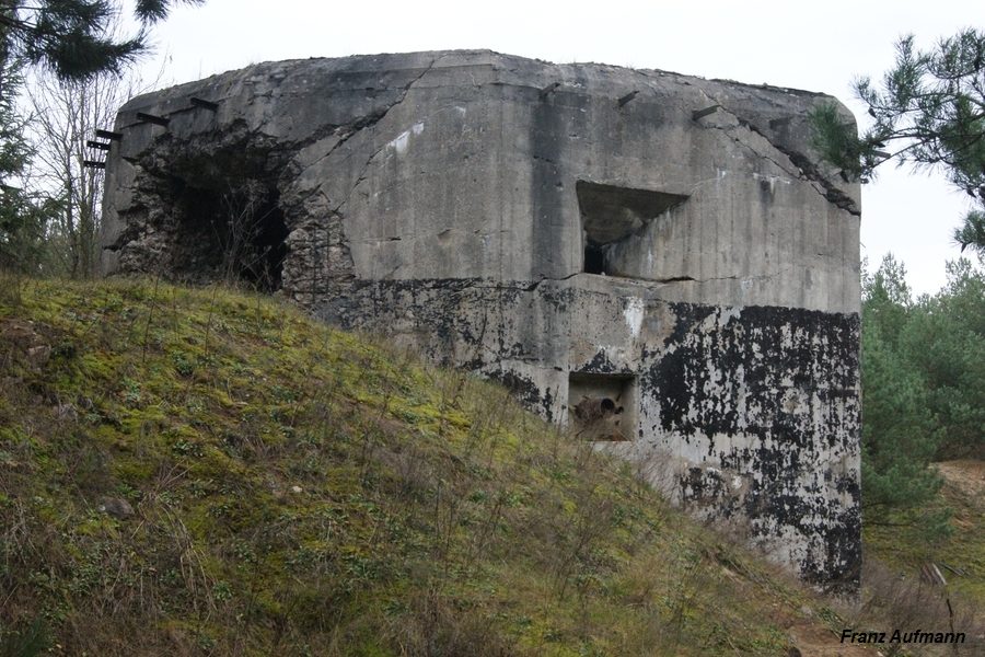

 Fot.
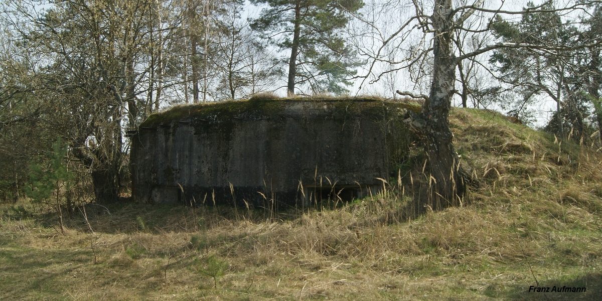
09. Prawa izba dla ckm ze ścianą ze sztywnym zabezpieczeniem
przeciwodłamkowego. (Linia Mołotowa, Rawsko-Ruski Rejon Umocniony, Mosty
Małe). Po lewej stronie wsporniki pod podstawę dla wentylatora,
usuwającego gazy prochowe.
Fot.
09. Prawa izba dla ckm ze ścianą ze sztywnym zabezpieczeniem
przeciwodłamkowego. (Linia Mołotowa, Rawsko-Ruski Rejon Umocniony, Mosty
Małe). Po lewej stronie wsporniki pod podstawę dla wentylatora,
usuwającego gazy prochowe.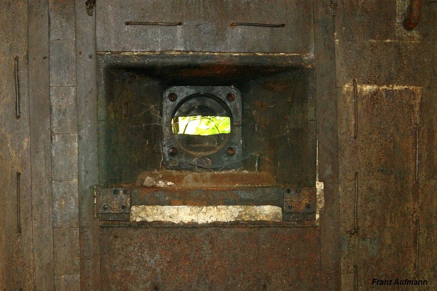
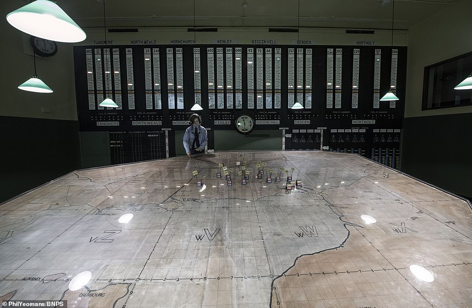
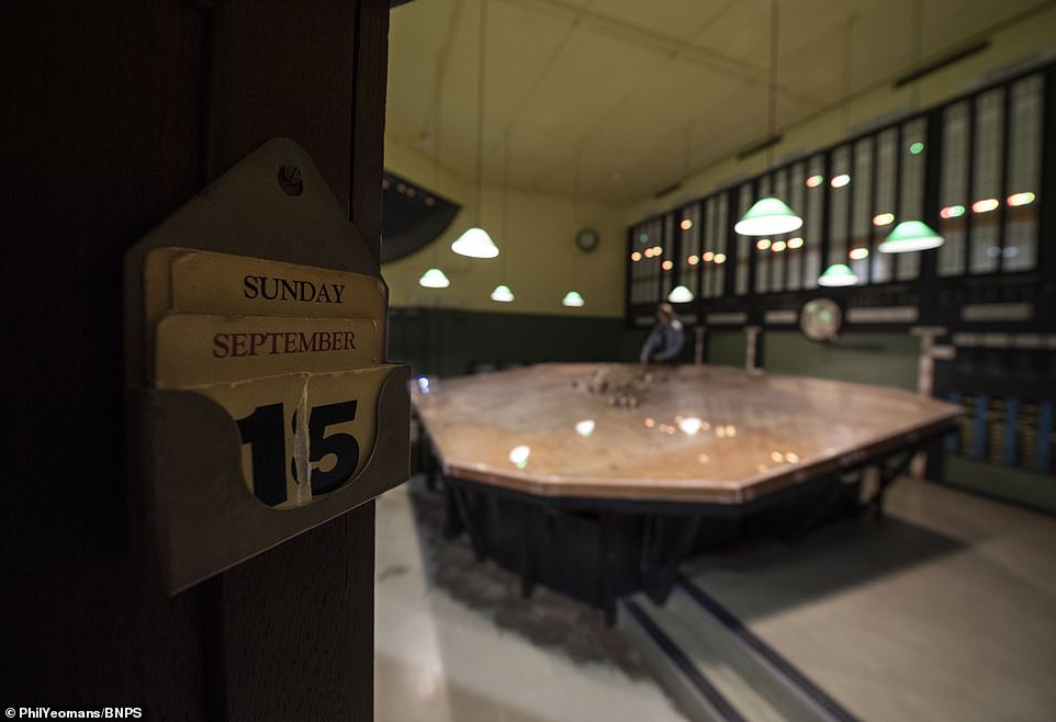
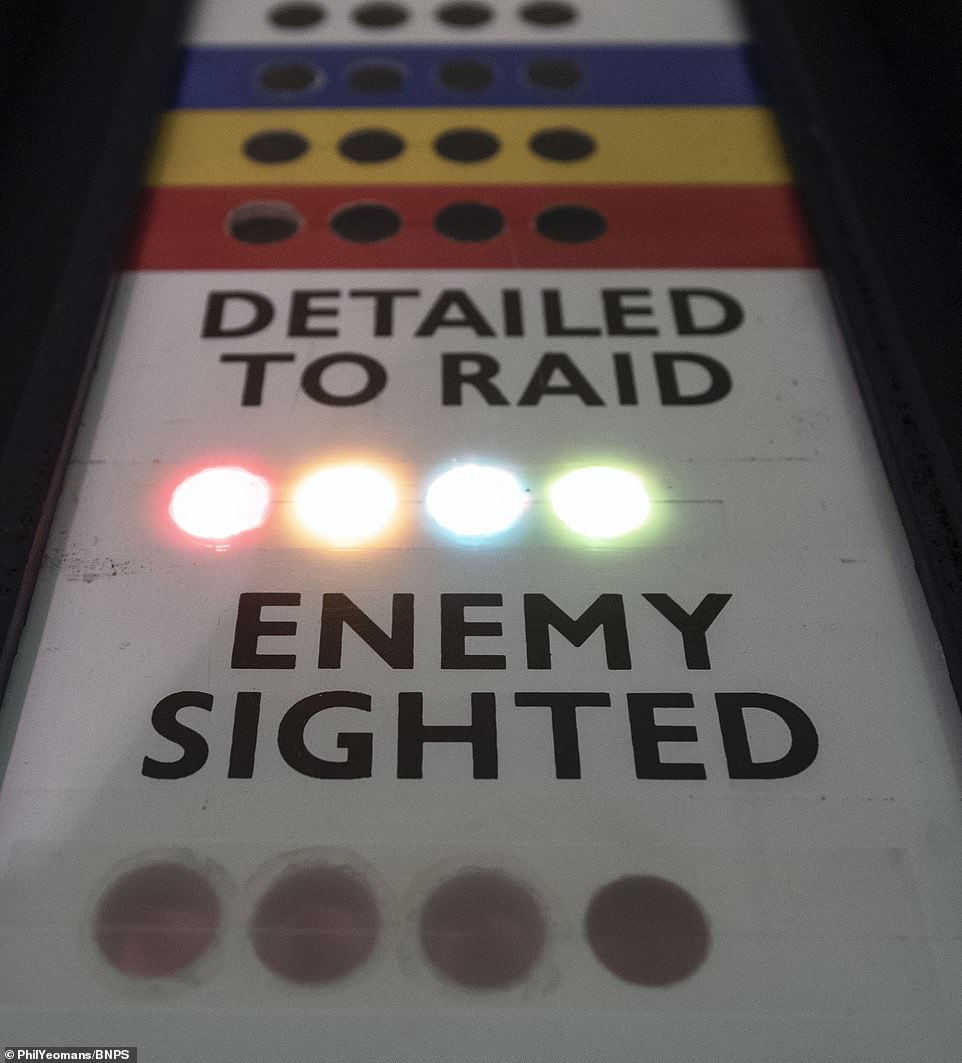
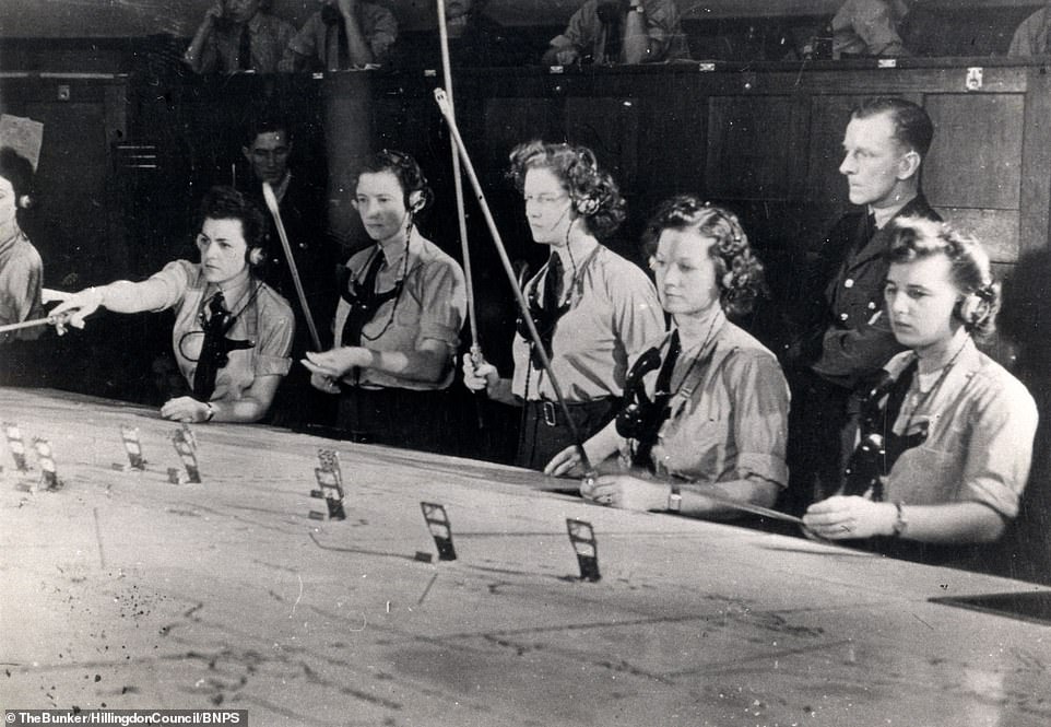
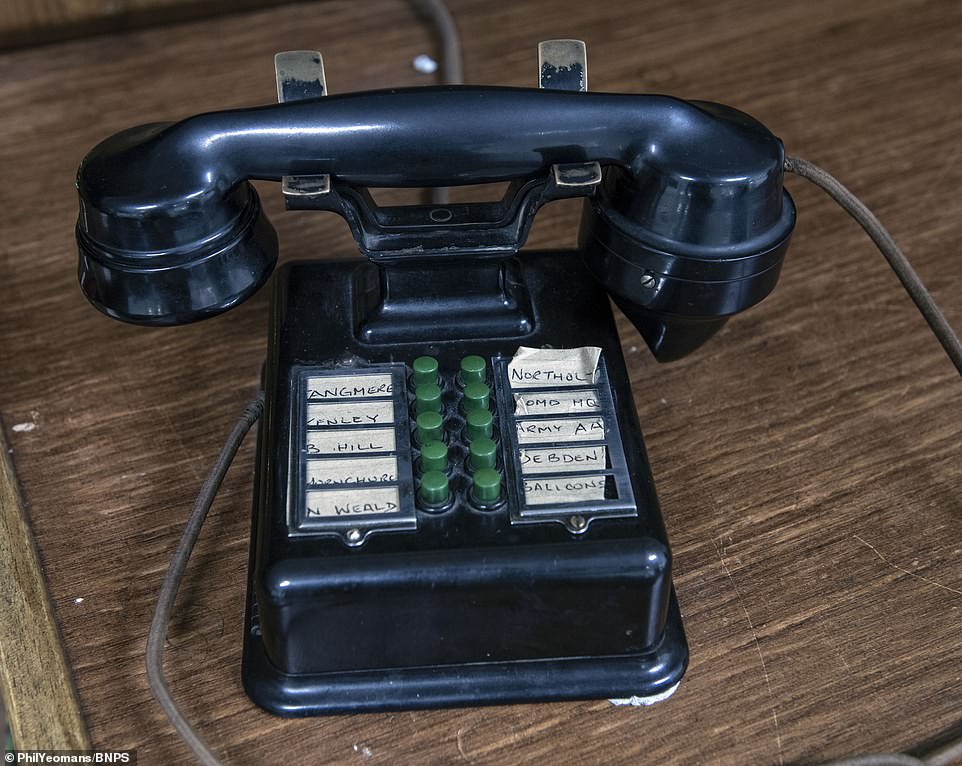
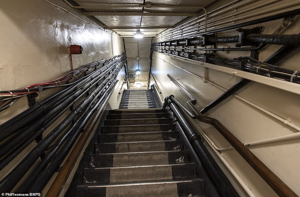
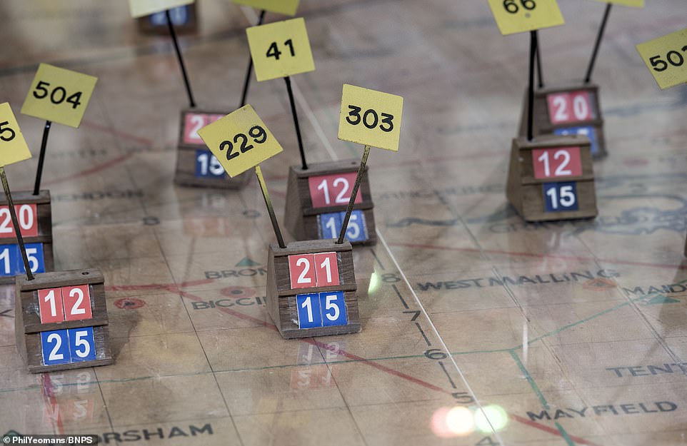
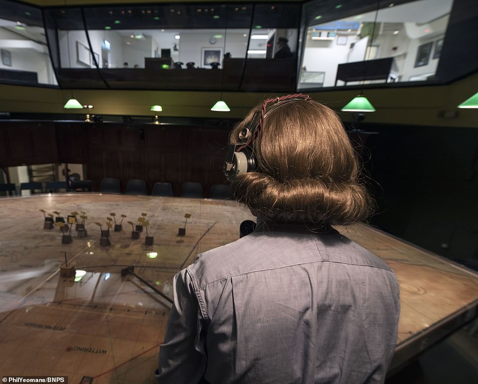
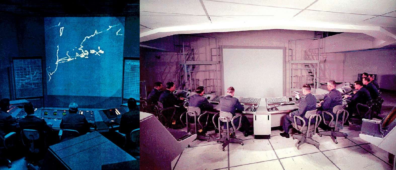
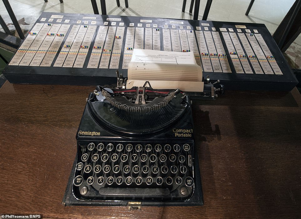 The
WAAF plotters would collate all the information on squadrons and then
record it on a typewriter, pictured, so it could then be transferred
onto paper tote boards and then eventually the electronic system.
The
WAAF plotters would collate all the information on squadrons and then
record it on a typewriter, pictured, so it could then be transferred
onto paper tote boards and then eventually the electronic system.


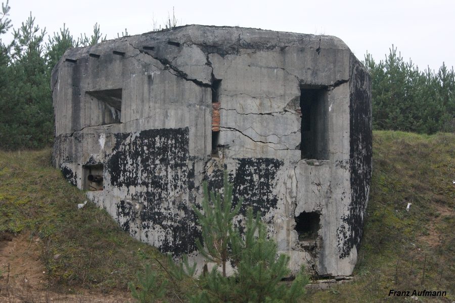
 Fot.
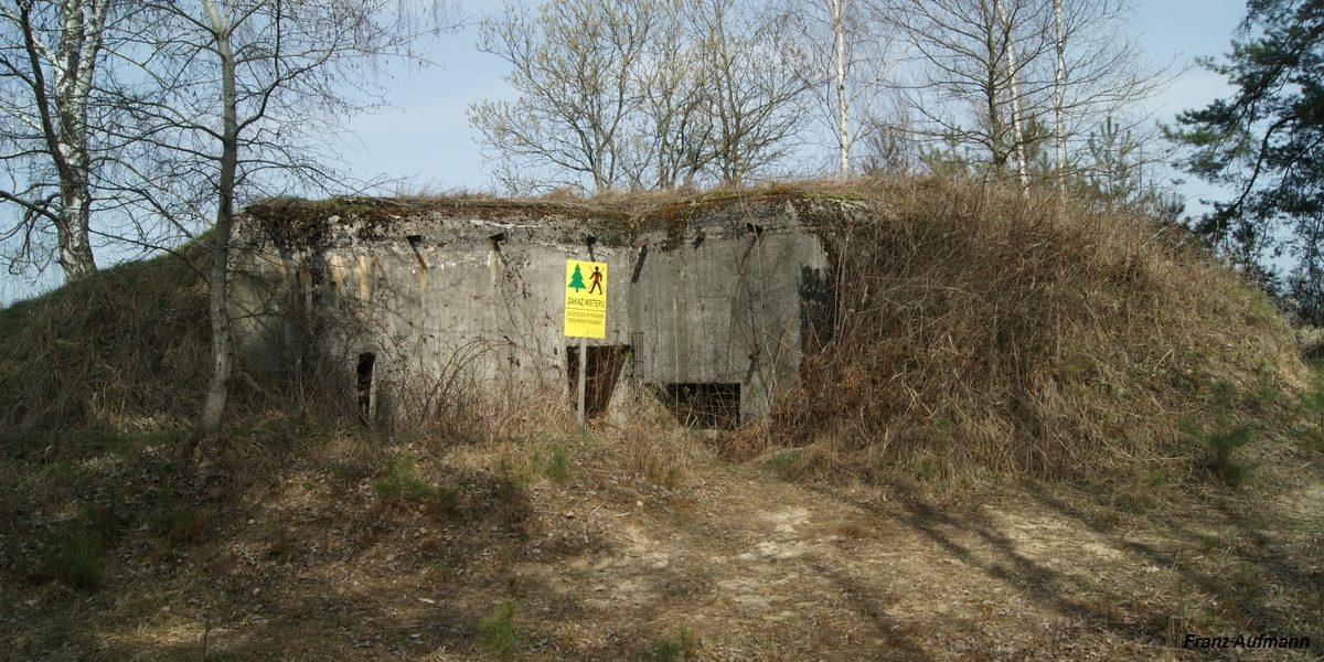
02. Linia Mołotowa. PPK – jednokondygnacyjny schron do ognia bocznego na
dwa ckmy i rkm. Od lewej: poziomy korytarz wyjścia ewakuacyjnego,
strzelnica obrony zapola i wejścia do schronu (Podemszczyzna, Rawsko
Ruski Rejon Umocniony).
Fot.
02. Linia Mołotowa. PPK – jednokondygnacyjny schron do ognia bocznego na
dwa ckmy i rkm. Od lewej: poziomy korytarz wyjścia ewakuacyjnego,
strzelnica obrony zapola i wejścia do schronu (Podemszczyzna, Rawsko
Ruski Rejon Umocniony).

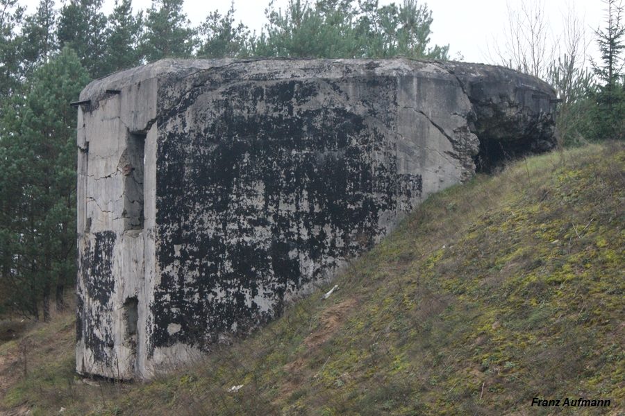
 Fot.
04. Wyjście ewakuacyjne bez wsuniętych dwuteowników.
Fot.
04. Wyjście ewakuacyjne bez wsuniętych dwuteowników.
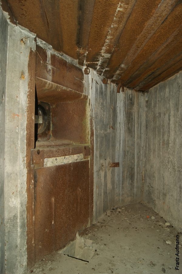
 Fot.
05. Wsporniki na podstawę wentylatora do usuwania gazów prochowych. W
lewym górnym rogu zdjęcia widoczna jest rura odprowadzająca gazy
prochowe na zewnatrz schronu (tłoczone przez wentylator). Po prawej
stronie zachowana część przewodu, odpowietrzająca zbiorniki z łuskami.
Fot.
05. Wsporniki na podstawę wentylatora do usuwania gazów prochowych. W
lewym górnym rogu zdjęcia widoczna jest rura odprowadzająca gazy
prochowe na zewnatrz schronu (tłoczone przez wentylator). Po prawej
stronie zachowana część przewodu, odpowietrzająca zbiorniki z łuskami.


 Первым
делом подхожу к одной из ракетных шахт. Первоначально на данном объекте
было шестнадцать пусковых установок для ракет А-350Ж. Впоследствии
позиции были переоборудованы под размещение дальнего компонента системы
А-135 с восьмью пусковыми установками ракет 51Т6.
Первым
делом подхожу к одной из ракетных шахт. Первоначально на данном объекте
было шестнадцать пусковых установок для ракет А-350Ж. Впоследствии
позиции были переоборудованы под размещение дальнего компонента системы
А-135 с восьмью пусковыми установками ракет 51Т6. Ракета
с ядерным боезарядом располагалась под двумя массивными створками,
способными в случае необходимости очень быстро отъехать в разные стороны
по специальным рельсам. Ныне все рельсы украдены, остались лишь
крепления для них.
Ракета
с ядерным боезарядом располагалась под двумя массивными створками,
способными в случае необходимости очень быстро отъехать в разные стороны
по специальным рельсам. Ныне все рельсы украдены, остались лишь
крепления для них.
 Внутри
всё давно затоплено.
Внутри
всё давно затоплено. Время
идти к локаторам.
Время
идти к локаторам. Всего
на территории их шесть: двое очень большие и ещё четыре поменьше.
Всего
на территории их шесть: двое очень большие и ещё четыре поменьше. Был
вариант зайти и осмотреть шары изнутри, но к сожалению фонарь я забыл
дома.
Был
вариант зайти и осмотреть шары изнутри, но к сожалению фонарь я забыл
дома. 
 А
это более крупный радиолокатор. В нишах когда-то стояли трансформаторы,
дающие электроэнергию для антенны. Неподалёку расположены действующие
подстанция и пожарная часть.
А
это более крупный радиолокатор. В нишах когда-то стояли трансформаторы,
дающие электроэнергию для антенны. Неподалёку расположены действующие
подстанция и пожарная часть. Это
странное сооружение обитое деревом викимапия называет градирней.
Это
странное сооружение обитое деревом викимапия называет градирней. Въезды
в здание для обслуживания противоракет.
Въезды
в здание для обслуживания противоракет. Внутри
пусто, но относительно чисто и интерьер до сих пор на месте, ещё не
успели распилить. Вероятно потому что действующий узел связи находится
напротив этого здания. Военные время от времени проходят мимо и пугают
визитёров рассказами о наличии здесь радиации, после
чего вежливо просят удалиться.
Внутри
пусто, но относительно чисто и интерьер до сих пор на месте, ещё не
успели распилить. Вероятно потому что действующий узел связи находится
напротив этого здания. Военные время от времени проходят мимо и пугают
визитёров рассказами о наличии здесь радиации, после
чего вежливо просят удалиться. Проходя
мимо действующего узла связи, я не стал его фотографировать. У меня на
этом пунктик - мысленное табу на съёмки действующих военных объектов.
Хотя в данном случае за это ничего бы не было, эту постройку уже
фотографировали другие люди посещавшие это место. Выглядит узел связи
как немаленький холм с оголовками вентшахт и большой фасадной стеной с
единственными въездными воротами. Рядом расположена аккуратная курилка
сделанная и дерева и сплетённых ивовых веток, прям в эко-стиле. Есть ещё
информационный щит и парковка с новенькими иномарками.
Проходя
мимо действующего узла связи, я не стал его фотографировать. У меня на
этом пунктик - мысленное табу на съёмки действующих военных объектов.
Хотя в данном случае за это ничего бы не было, эту постройку уже
фотографировали другие люди посещавшие это место. Выглядит узел связи
как немаленький холм с оголовками вентшахт и большой фасадной стеной с
единственными въездными воротами. Рядом расположена аккуратная курилка
сделанная и дерева и сплетённых ивовых веток, прям в эко-стиле. Есть ещё
информационный щит и парковка с новенькими иномарками.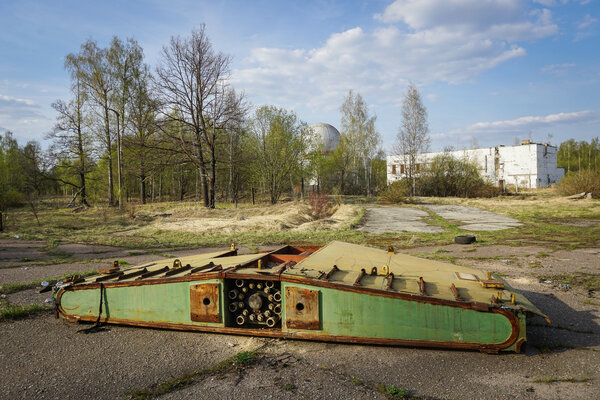 Видимо
это останки створчатого механизма прикрывавшего ракетную шахту.
Видимо
это останки створчатого механизма прикрывавшего ракетную шахту. Здание
дизельной электростанции. Рядом с ним выкопано очередное убежище.
Здание
дизельной электростанции. Рядом с ним выкопано очередное убежище.


 В
чём-то провинившийся водолазные костюм, прибитый к дереву в качестве
наказания.
В
чём-то провинившийся водолазные костюм, прибитый к дереву в качестве
наказания. Судя
по обстановке вокруг: баррикадам из досок, раскопанной земле и пафосным
надписям это место захватили дети и устроили здесь подобие крепости.
Судя
по обстановке вокруг: баррикадам из досок, раскопанной земле и пафосным
надписям это место захватили дети и устроили здесь подобие крепости. Наверху
есть мешки с песком, так что возможно дело не в детях, а в более
взрослых детях - страйкболистами которых зовут.
Наверху
есть мешки с песком, так что возможно дело не в детях, а в более
взрослых детях - страйкболистами которых зовут. Перед
тем как уехать домой, заезжаю в бывший военный городок Наро-Фоминск 10.
Сам по себе городок совершенно обычный, один из многих. Сильно похож на
Клин-9 в котором я побывал во время службы в армии. Рядом с Клином-9
тоже имеется противоракетный центр, тоже есть заброшенные позиции
ракетных комплесов охранявших небо Москвы. По
Перед
тем как уехать домой, заезжаю в бывший военный городок Наро-Фоминск 10.
Сам по себе городок совершенно обычный, один из многих. Сильно похож на
Клин-9 в котором я побывал во время службы в армии. Рядом с Клином-9
тоже имеется противоракетный центр, тоже есть заброшенные позиции
ракетных комплесов охранявших небо Москвы. По Афиша
нарисованная вручную.
Афиша
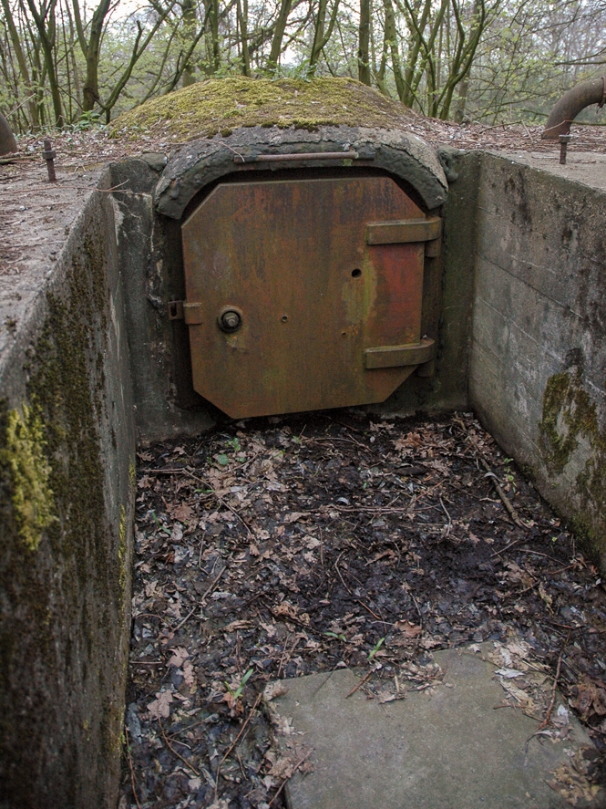
нарисованная вручную. Вход
в заброшенное бомбоубежище.
Вход
в заброшенное бомбоубежище.


.jpg)


 Są
miejsca, do których warto co jakiś czas powrócić. Z pewnością takim
miejscem jest Twierdza „Modlin”. Zabudowa forteczna, położona w
północnej części Nowego Dworu Mazowieckiego leży niespełna czterdzieści
kilometrów od Warszawy i w moim subiektywnym przekonaniu jest jednym z
najciekawszych obiektów w naszym regionie, gdzie spędzić można pierwszą
tak słoneczną iciepłą sobotę tego roku.
Są
miejsca, do których warto co jakiś czas powrócić. Z pewnością takim
miejscem jest Twierdza „Modlin”. Zabudowa forteczna, położona w
północnej części Nowego Dworu Mazowieckiego leży niespełna czterdzieści
kilometrów od Warszawy i w moim subiektywnym przekonaniu jest jednym z
najciekawszych obiektów w naszym regionie, gdzie spędzić można pierwszą
tak słoneczną iciepłą sobotę tego roku.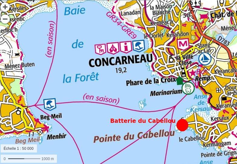
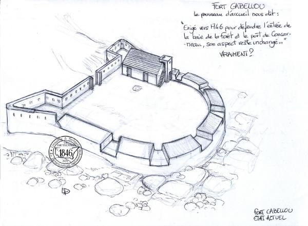
 Pourtant,
le texte du panneau signalétique sur place est catégorique:
Pourtant,
le texte du panneau signalétique sur place est catégorique:

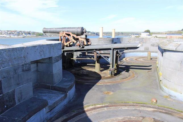
 En
1747, comme trente ans plus tard, son armement est constitué de quatre
canons de 22 livres (calibre anglais !).
En
1747, comme trente ans plus tard, son armement est constitué de quatre
canons de 22 livres (calibre anglais !).
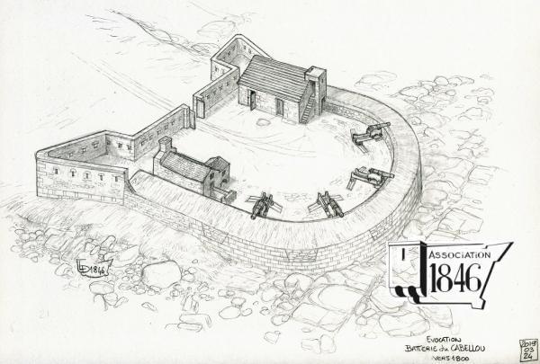 Un
document non daté, mais sur lequel figure le fourneau ŕ réverbčre ŕ
rougir les boulets mentionné au moins dčs 1803 - mais trčs probablement
construit au début des guerres de la Révolution - représente le parapet
de la batterie sans embrasures.
Un
document non daté, mais sur lequel figure le fourneau ŕ réverbčre ŕ
rougir les boulets mentionné au moins dčs 1803 - mais trčs probablement
construit au début des guerres de la Révolution - représente le parapet
de la batterie sans embrasures.
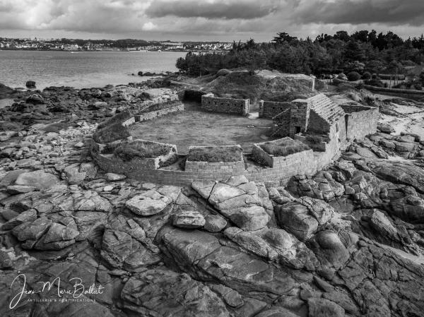
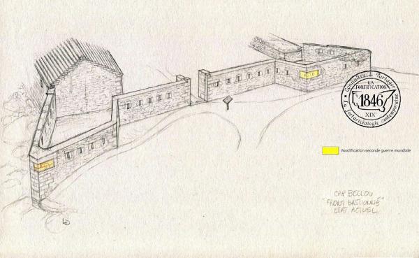 La
batterie sert durant toute la durée des guerres de la Révolution et de
l'Empire avec le męme armement de quatre pičces de 36 (la commission de
défense des côtes de 1841 précise que de 1803 ŕ 1808 elle tire 137 coups).
La
batterie sert durant toute la durée des guerres de la Révolution et de
l'Empire avec le męme armement de quatre pičces de 36 (la commission de
défense des côtes de 1841 précise que de 1803 ŕ 1808 elle tire 137 coups).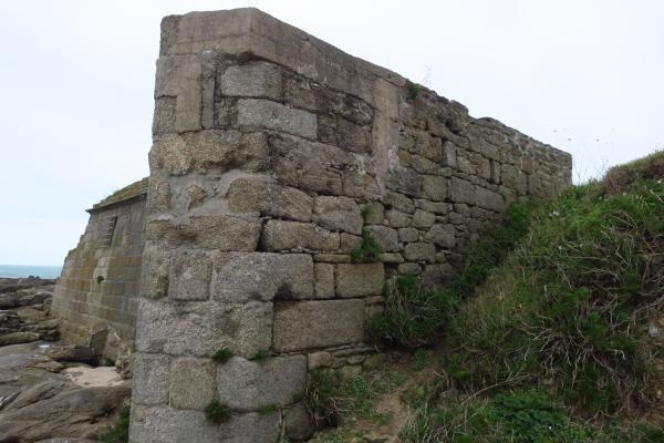 La
commission de défense des côtes de 1859 décide l'abandon de la batterie.
La
commission de défense des côtes de 1859 décide l'abandon de la batterie.
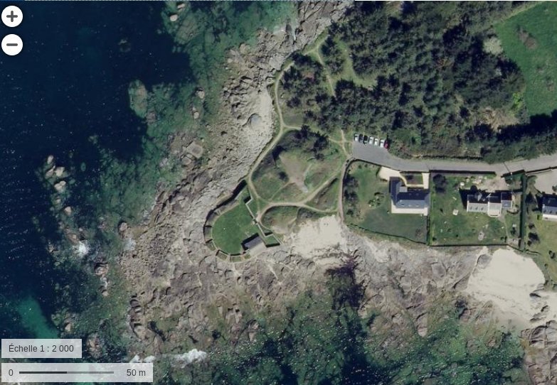
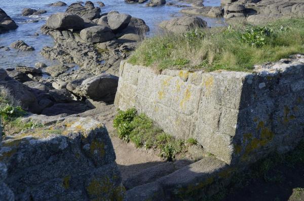 La
batterie est acquise par la ville de Concarneau en 1960 et classée
Monument historique en 1962.
La
batterie est acquise par la ville de Concarneau en 1960 et classée
Monument historique en 1962.

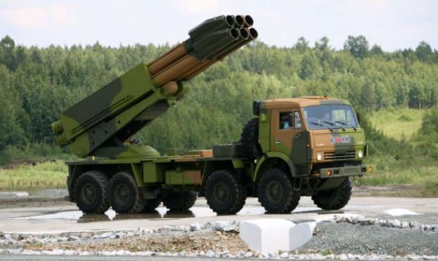
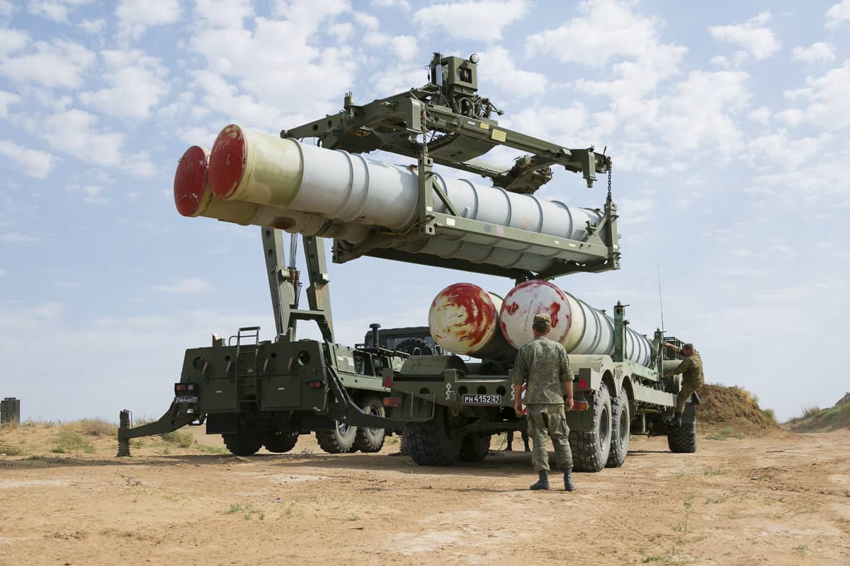
 Lockheed
Martin has won a $1.13 billion contract from the United States Army for
Lot 14 production of Guided Multiple Launch Rocket System (GMLRS)
rockets and associated equipment.
Lockheed
Martin has won a $1.13 billion contract from the United States Army for
Lot 14 production of Guided Multiple Launch Rocket System (GMLRS)
rockets and associated equipment.


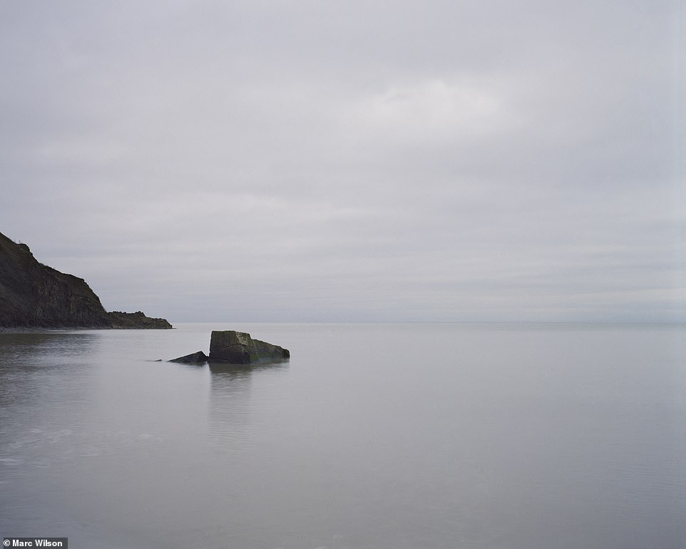
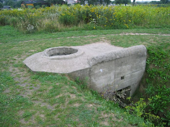
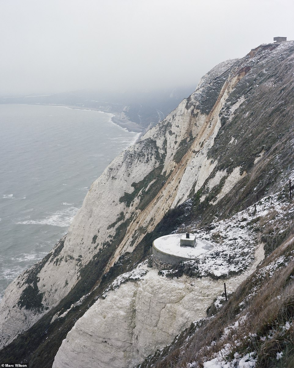 Abbot's
Cliff, Kent: Located between Dover and Folkestone, this was one of the
new anti-invasion defences built for the Second World War.
Abbot's
Cliff, Kent: Located between Dover and Folkestone, this was one of the
new anti-invasion defences built for the Second World War.
 Brean
Down, Somerset: This 19th-century Palmerston Fort 60ft above sea level
was part of a chain of defences protecting the approaches to Bristol and
Cardiff.
Brean
Down, Somerset: This 19th-century Palmerston Fort 60ft above sea level
was part of a chain of defences protecting the approaches to Bristol and
Cardiff.
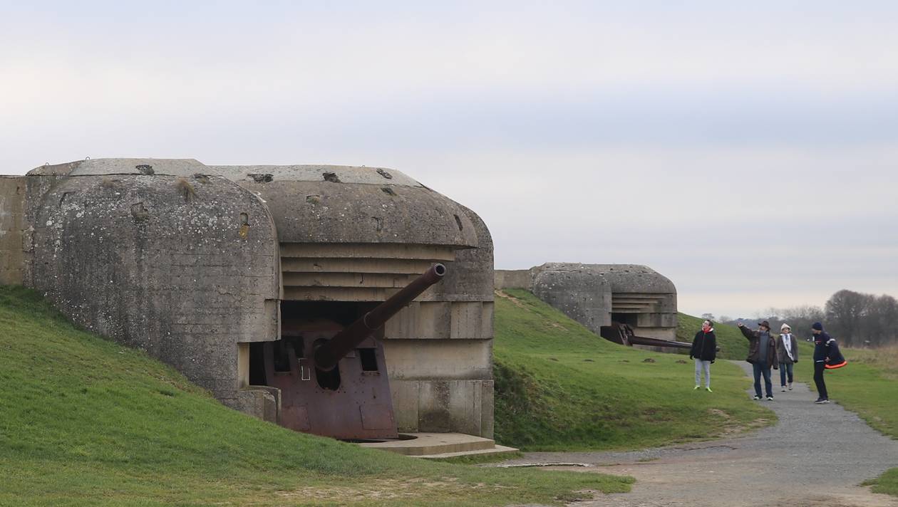
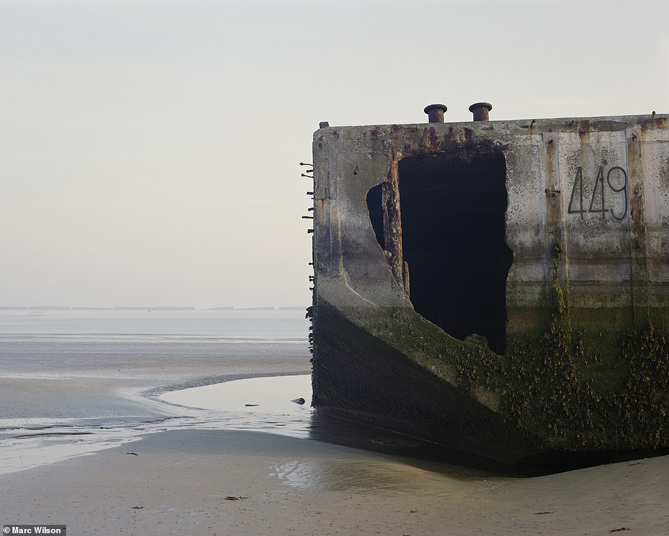 Arromanche-les-Bains,
Normandy: The commune was at the centre of the Gold Beach landing zone
during D-Day in June 1944, and became the location for where the British
built one of the Mulberry Harbour sites, called Port Winston.
Arromanche-les-Bains,
Normandy: The commune was at the centre of the Gold Beach landing zone
during D-Day in June 1944, and became the location for where the British
built one of the Mulberry Harbour sites, called Port Winston.
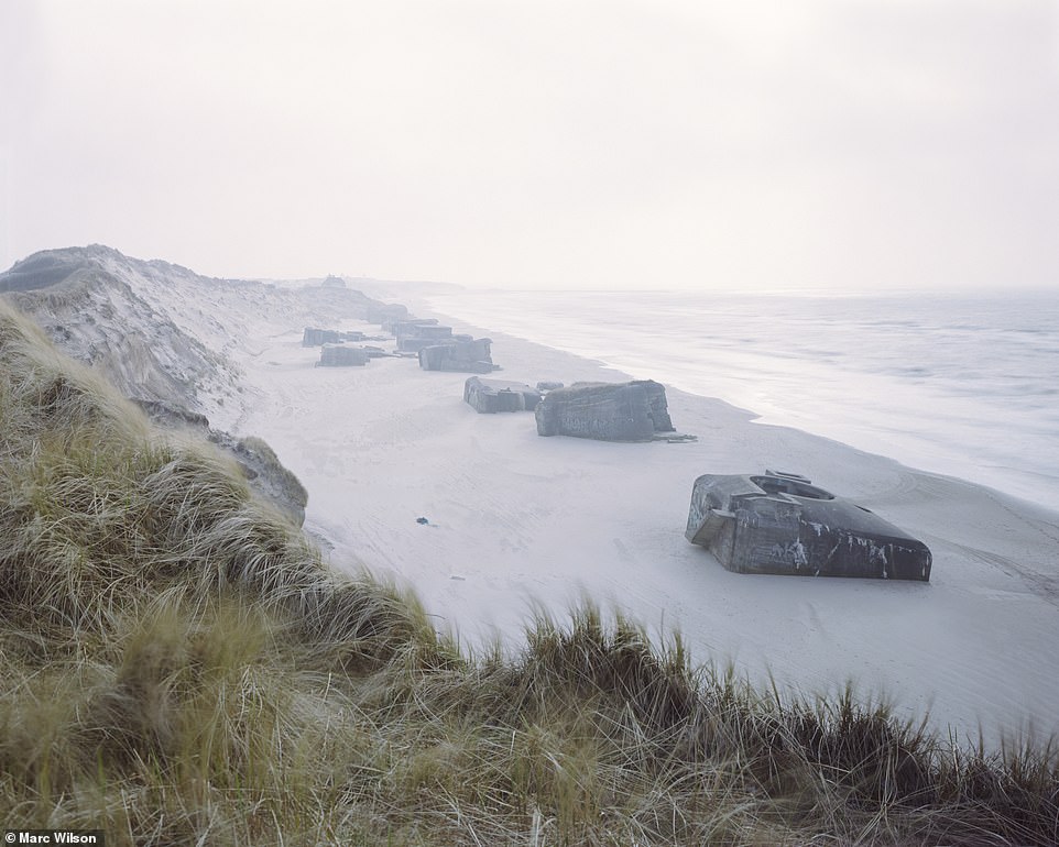 Lřkken,
Nordjylland, Denmark: April 1940 brought the world's first airborne
invasion when hundreds of German paratroopers landed in Denmark and
seized the Aalborg airfield in North Jutland.
Lřkken,
Nordjylland, Denmark: April 1940 brought the world's first airborne
invasion when hundreds of German paratroopers landed in Denmark and
seized the Aalborg airfield in North Jutland.
 Spurn
Point, East Yorkshire: The curving sand-and-shingle spit was leased in
the First World War and then bought by the War Department, which built
fortifications and gun batteries protecting ports along the River Humber
from attack.
Spurn
Point, East Yorkshire: The curving sand-and-shingle spit was leased in
the First World War and then bought by the War Department, which built
fortifications and gun batteries protecting ports along the River Humber
from attack.
 Isle
of Sheppey, Kent: The Warden Point acoustic mirror - a device used to
reflect and focus sound waves - had been part of the Thames Estuary
Defence early-warning system.
Isle
of Sheppey, Kent: The Warden Point acoustic mirror - a device used to
reflect and focus sound waves - had been part of the Thames Estuary
Defence early-warning system.
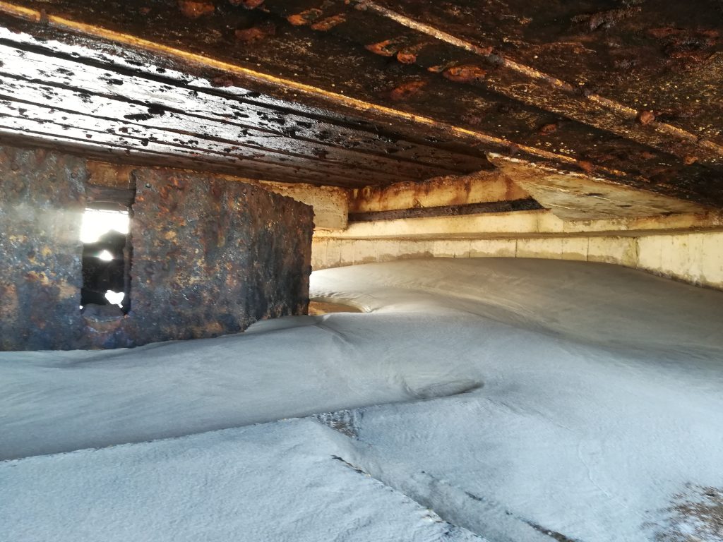
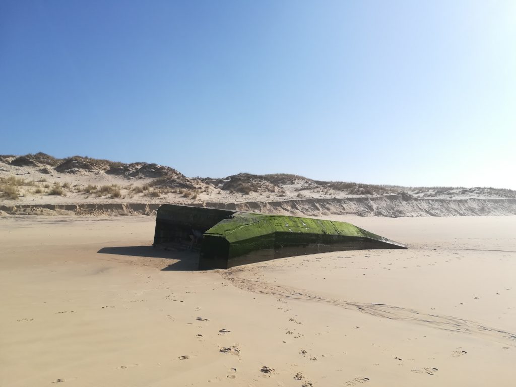
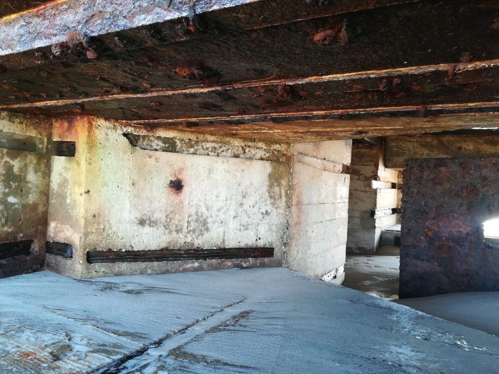
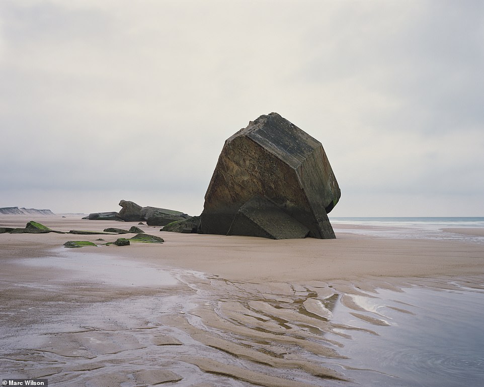 Capbreton,
Aquitaine, France: The port of Capbreton, which was part of the Atlantic
Wall, had four 105mm (4in) guns in the first row of dunes near the beach
and mounted in a separate casemate.
Capbreton,
Aquitaine, France: The port of Capbreton, which was part of the Atlantic
Wall, had four 105mm (4in) guns in the first row of dunes near the beach
and mounted in a separate casemate.
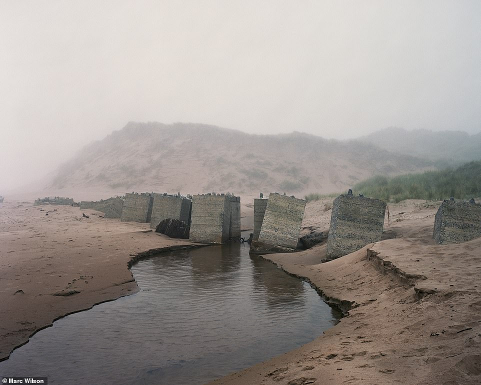 Newburgh,
Aberdeenshire: These two pictures show parts of a 1km (1.5 mile)-long
anti-tank wall built across the sand dunes, 100 yards inland.
Newburgh,
Aberdeenshire: These two pictures show parts of a 1km (1.5 mile)-long
anti-tank wall built across the sand dunes, 100 yards inland.
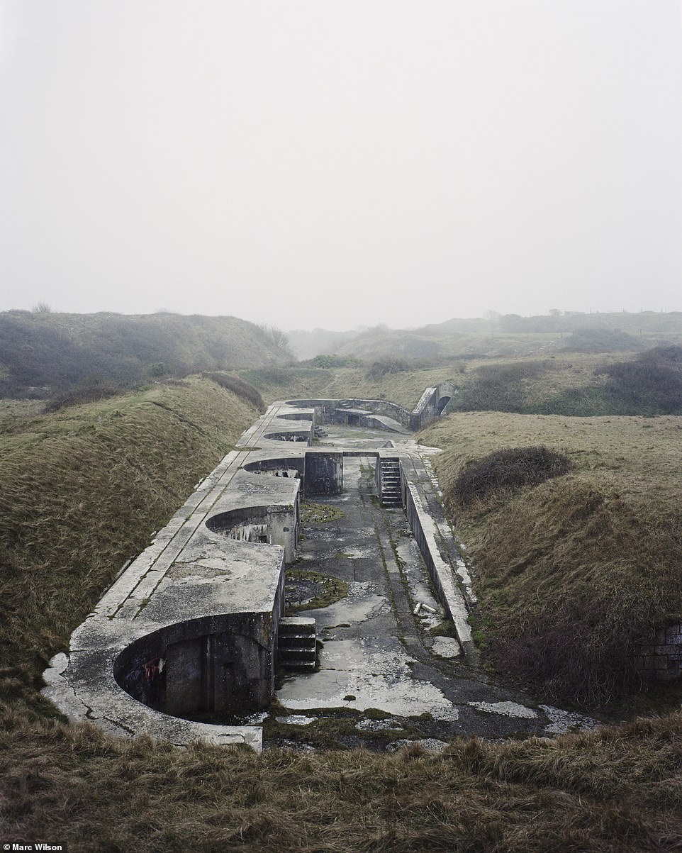 Portland,
Dorset: The Verne Battery was built in 1892 in a disused stone quarry as
part of Britain's coastal defences.
Portland,
Dorset: The Verne Battery was built in 1892 in a disused stone quarry as
part of Britain's coastal defences.
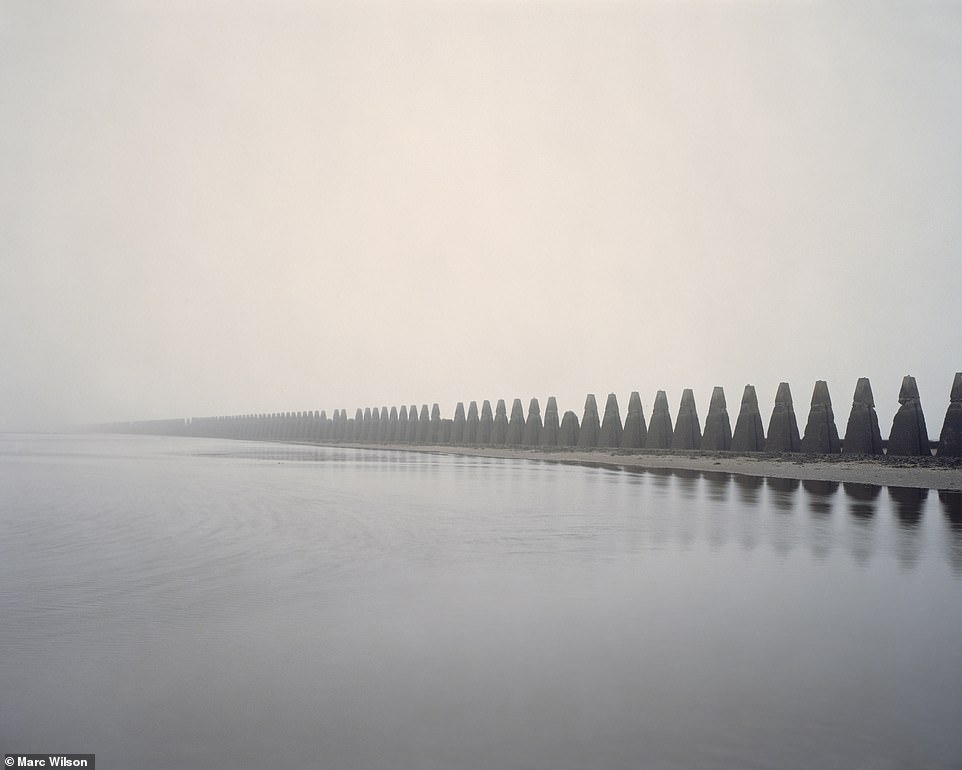 Cramond
Island, Firth of Forth: An anti-submarine barrier, known as 'the
dragon's teeth', was built along the causeway between the village of
Cramond and Cramond Island.
Cramond
Island, Firth of Forth: An anti-submarine barrier, known as 'the
dragon's teeth', was built along the causeway between the village of
Cramond and Cramond Island.


 This
initiative was a way of pressuring NATO and national authorities to
consider employing women more widely within their Services.
This
initiative was a way of pressuring NATO and national authorities to
consider employing women more widely within their Services.


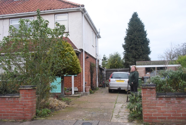 The
house with the 80-year-old secret, a World War Two air-raid shelter
hidden away in the front garden in Waldemar Avenue. Picture: DENISE
BRADLEY
The
house with the 80-year-old secret, a World War Two air-raid shelter
hidden away in the front garden in Waldemar Avenue. Picture: DENISE
BRADLEY


