


 Solar
on s’ubica el refugi (fotografia prňpia)
Solar
on s’ubica el refugi (fotografia prňpia)


 Fot.
01. Linia
Mołotowa.
OPDOT –
dwukondygnacyjny
schron na
dwa ckm-y i
45 mm armatę
przeciwpancerną
w prawej
izbie (Przyborowo
– Osowiecki
Rejon
Umocniony).
Fot.
01. Linia
Mołotowa.
OPDOT –
dwukondygnacyjny
schron na
dwa ckm-y i
45 mm armatę
przeciwpancerną
w prawej
izbie (Przyborowo
– Osowiecki
Rejon
Umocniony).
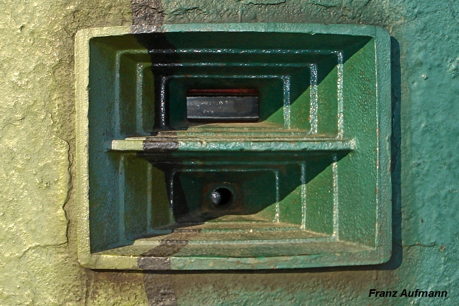
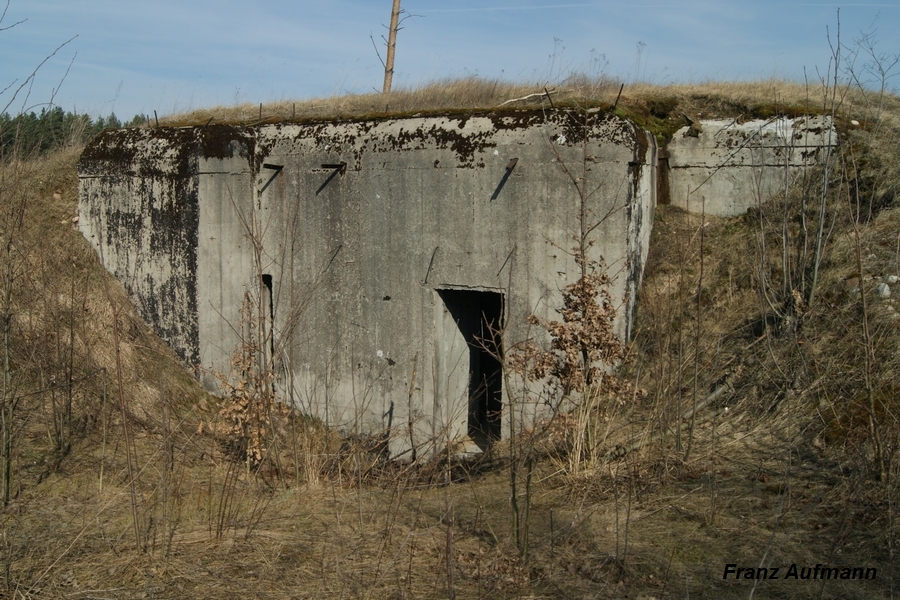
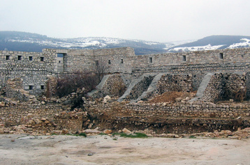
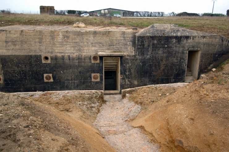
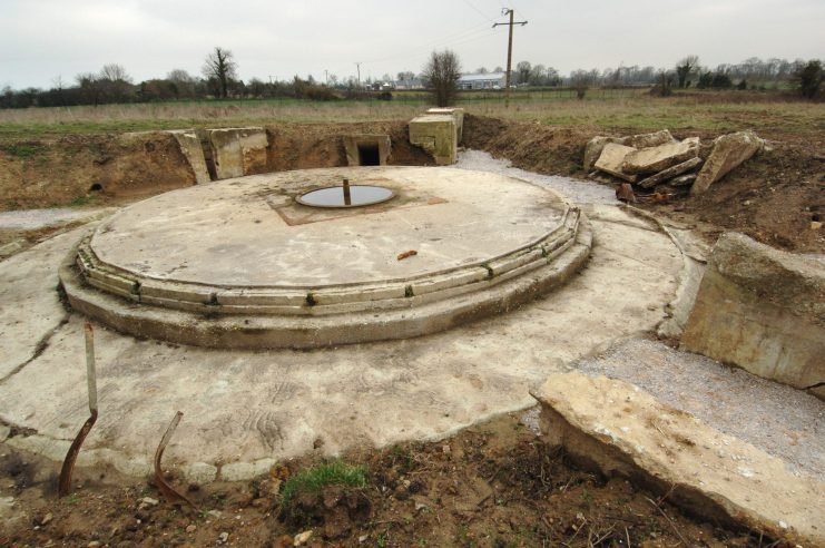
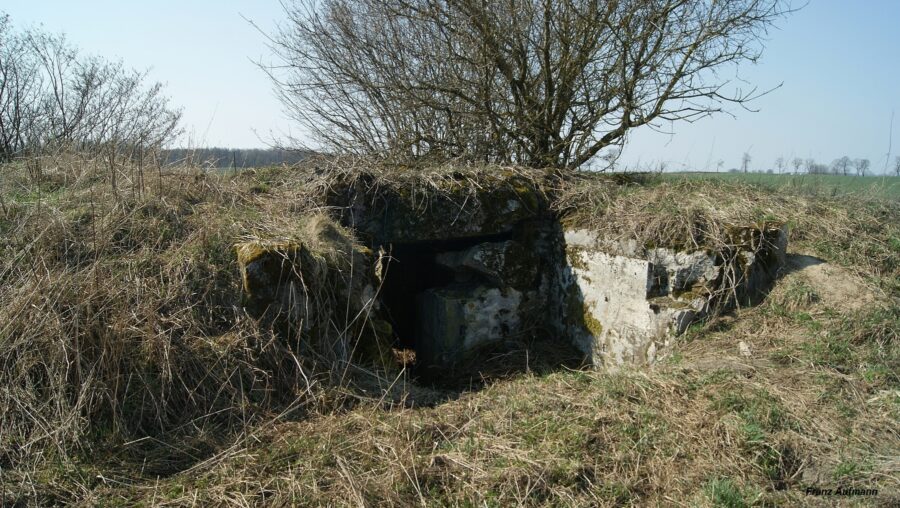
Fot. 02. Linia Mołotowa. OPDOT – dwukondygnacyjny schron na dwa ckm-y i 45 mm armatę przeciwpancerną w prawej izbie (Przyborowo – Osowiecki Rejon Umocniony). Widok od strony przedpola w kierunku południowo – zachodnim.
Konstrukcja dwukondygnacyjnego schronu na dwa ckm-y i 45 mm armatę przeciwpancerną w prawej izbie (OPDOT) (ros. двуэтажная ОПДОТ на две пулемётные установки и 45 мм пушку в правом каземате) pochodzi z 1940 roku. W dwóch izbach, lewej i centralnej, znajduje się po jednym stanowisku bojowym dla 7,62 mm ciężkich karabinów maszynowych wz. 1910 Maxim (NPS-3). W prawej izbie umieszczono stanowisko 45 mm armaty przeciwpancernej sprzężonej z 7,62 mm ciężkim karabinem maszynowym wz. 39 DS.

 Fot.
03. Linia
Mołotowa.
OPDOT –
dwukondygnacyjny
schron na
dwa ckm-y i
45 mm armatę
przeciwpancerną
w prawej
izbie (Przyborowo
– Osowiecki
Rejon
Umocniony).
Widok od
strony
przedpola w
kierunku
południowym.
Fot.
03. Linia
Mołotowa.
OPDOT –
dwukondygnacyjny
schron na
dwa ckm-y i
45 mm armatę
przeciwpancerną
w prawej
izbie (Przyborowo
– Osowiecki
Rejon
Umocniony).
Widok od
strony
przedpola w
kierunku
południowym.
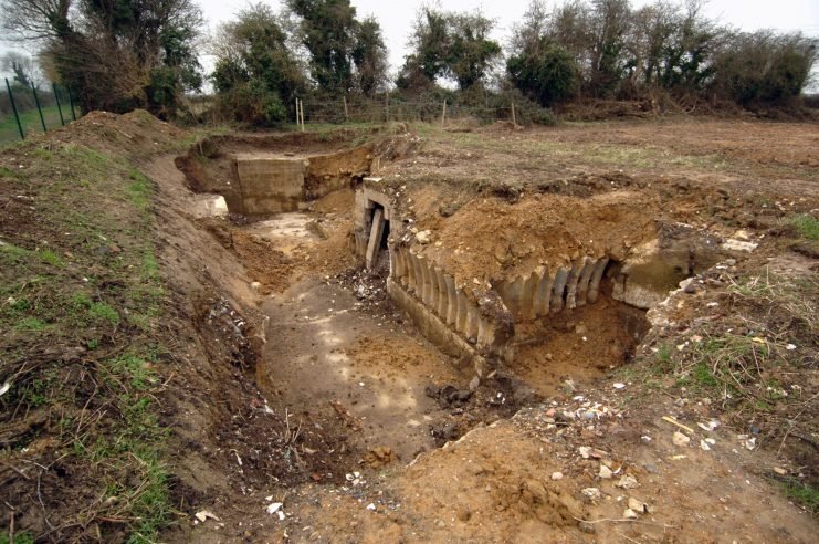
Fot. 04. Linia Mołotowa. OPDOT – dwukondygnacyjny schron na dwa ckm-y i 45 mm armatę przeciwpancerną w prawej izbie (Przyborowo – Osowiecki Rejon Umocniony). Widok od strony zapola w kierunku północno – zachodnim. Po lewej stronie zdjęcia widoczna jest przedłużona ściana boczna schronu.
Łączny sektor ognia z trzech stanowisk bojowych wynosił 170 stopni. W odległości 39-40 metrów od schronu zanika pole martwe. Sektory ognia (60 stopni w płaszczyźnie poziomej) z sąsiadujących strzelnic zaczynają się uzupełniać.


Fot. 05. Linia Mołotowa. OPDOT – dwukondygnacyjny schron na dwa ckm-y i 45 mm armatę przeciwpancerną w prawej izbie (Podbiele – Zambrowski Rejon Umocniony).
Fot. 06. Linia Mołotowa. OPDOT – dwukondygnacyjny schron na dwa ckm-y i 45 mm armatę przeciwpancerną w prawej izbie (Podbiele – Zambrowski Rejon Umocniony). Widok od strony zapola.
Fot. 07. Linia Mołotowa. OPDOT – dwukondygnacyjny schron na dwa ckm-y i 45 mm armatę przeciwpancerną w prawej izbie (Podbiele – Zambrowski Rejon Umocniony). Widok wejścia do schronu z okapem i przedłużoną prawą ścianą.
Schron należał to typu obiektów często występujących na „Linii Mołotowa” (nieformalna nazwa). Konstrukcja standardowego schronu mogła być modyfikowana w zależności od wymagań taktyczno-obronnych danego punktu oporu. Obiekt tego typu, ze zmianami wynikającymi z planu ogni, znajduje się w pobliżu miejscowości Przyborowo (Osowiecki RU).


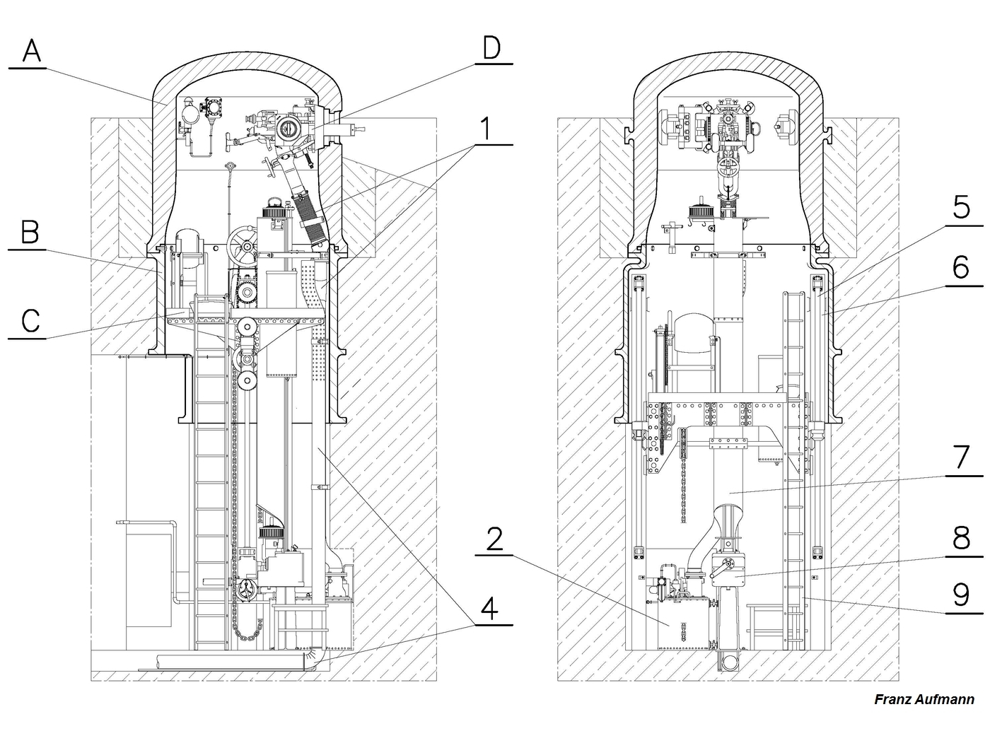
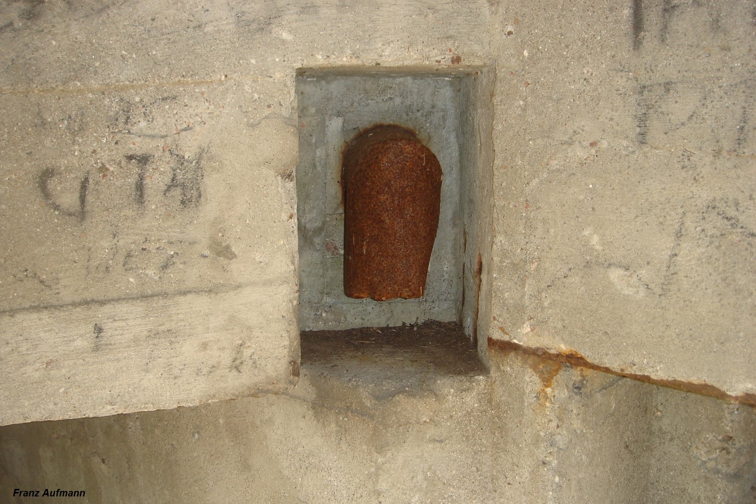
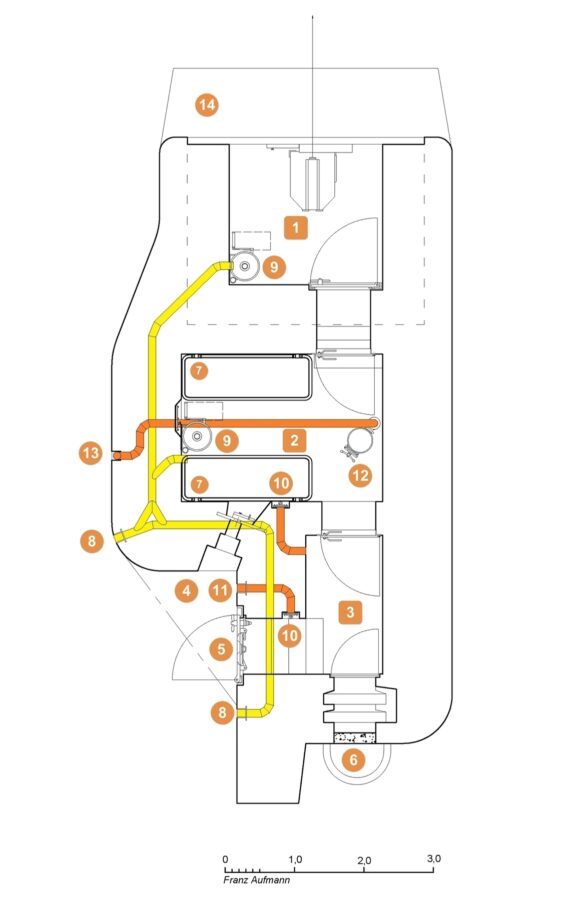
Rys. 01. Rzut poziomy górnej kondygnacji schronu na dwa ckm-y i 45 mm armatę przeciwpancerną w prawej izbie (OPDOT). -1. izba bojowa na ckm, -2. izba bojowa dla armaty przeciwpancernej sprzężonej z ckm, -3. izba dowodzenia, -4. izba ze składem amunicji, - . pomieszczenie z pionowym szybem łączącym obie kondygnacje, -6. śluza przeciwgazowa, -7. korytarz wejściowy do schronu.
Rys.02. Rzut poziomy dolnej kondygnacji schronu na dwa ckm-y i 45 mm armatę przeciwpancerną w prawej izbie (OPDOT). -8. izba załogi, -9. pomieszczenie techniczne dla filtrów przeciwchemicznych i wentylatora, -10. maszynownia z agregatem prądotwórczym, - 1. pomieszczenie pomocnicze z wyjściem ewakuacyjnym, -12. WC, -13. pomieszczenie z pionowym szybem łączącym obie kondygnacje.
Rys. 03. Tylna elewacja dwukondygnacyjnego schronu na dwa ckm-y i 45 mm armatę przeciwpancerną w prawej izbie (OPDOT). -A. standardowe rozwiązanie, -B. rozwiązanie z przedłużoną ścianą boczną i okapem nad wejściem.
Zastosowano jedno z dwóch typowych rozwiązań. Lewa (zachodnia) ściana boczna schronu została wzmocniona i wydłużona (Fot. 04 i Rys. 01) poza tylną elewację mimo przewidzianego dla obiektów typu OPDOT bocznego nasypu kamienno – ziemnego. Jej zadaniem była ochrona wejściem, przed bocznym ostrzałem i osuwaniem nasypu kamienno- ziemnego. Obiekt znajdował się w sektorze ognia sąsiedniego schronu OPPK oddalonego o około 600 metrów w kierunku zachodnim.
Wyposażanie schronu zakończono na etapie osadzania pancerzy uzbrojenia głównego. Osadzono jedynie dwa staliwne pancerze skrzynkowe dla ciężkich karabinów maszynowych (NPS-3). Nie przeprowadzono czynności przygotowawczych do uzbrojenia pancerzy. Dla stanowiska armaty przeciwpancernej, mającego sektor ognia w kierunku północno-wschodnim, pozostawiono niezabezpieczony otwór technologiczny.
Drugim spotykanym rozwiązaniem, przedstawionym na Fot. 05-07 i Rys. 03 B, było wydłużenie ściany bocznej i zastosowanie okapu nad wejściem do schronu. Tak zmodyfikowaną cześć tylną posiada schron OPDOT na dwa ckm-y i armatę przeciwpancerną w prawej izbie bojowej należący do punku oporu w pobliżu miejscowości Podbiele (Zambrowski RU). Okap zaczyna się na wysokości szczeliny przeciw podmuchowej.


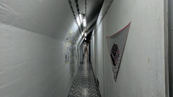
Fot. 08. Korytarz wejściowy do schronu. Na pierwszym planie wsporniki do mocowania drzwi kratowych. W głębi wewnętrzna strzelnica obrony wejścia.
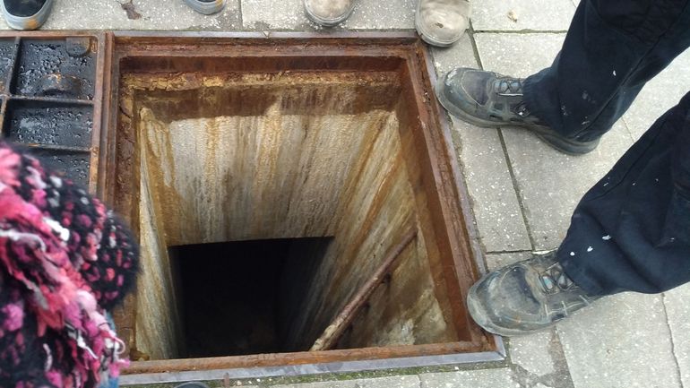
Fot. 09. Korytarz wejściowy do schronu. Po prawej stronie ościeżnica ciężkich gazoszczelnych drzwi wejściowych. Po lewej stronie otwór do czyszczenia szamba, znajdującego się pod dolna kondygnacją.
Fot. 10. Korytarz wejściowy do schronu. Po lewej stronie wewnętrzna strzelnica obrony wejścia. Na wprost widok niszy czerpni powietrza, jednej z dwóch.
Fot. 11. Widok drugiej niszy czerpni powietrza od strony śluzy przeciwgazowej. Na pierwszym planie ościeżnica ciężkich gazoszczelnych drzwi wejściowych.
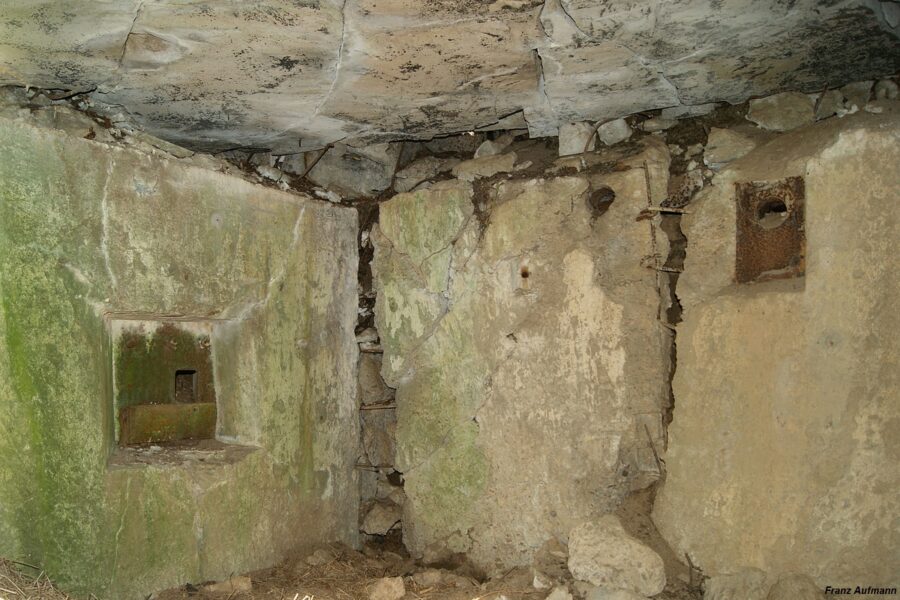
Obiekt z miejscowości Podbiele pozbawiony został osadzonych pancerzy. Siła eksplozji pochyliła tylną ścianę centralnej izby bojowej dla ckm. Cechą charakterystyczną radzieckich schronów były “małe” grubości ścian wewnętrznych. W tym wypadku grubość tylnej ściany izby bojowej wynosiła 30 cm. Najcieńsze ściany działowe posiadały grubość około 18 cm.
W elewacji schronu, osadzono równoramienne kątowniki 50×50 a poniżej nich zaczepy wykonane z gładkich prętów zbrojeniowych. Służyły do mocowania ruchomych wsporników. Podtrzymywały one rozpięte maty lub siatkę maskującą. W przypadku omawianego typu schronu OPDOT osadzone były w ścianie tylnej z wejściem i ścianach czołowych ze strzelnicami. Przewidziano standardowy sposób maskowania na “pagórek”.
Schron, zgodnie z przyjętymi zasadami w sowieckiej fortyfikacji stałej, powinien posiadać boczne ściany zabezpieczone nasypem kamienno – ziemnym. Obsyp ziemny i maskowanie wykonywano w ostatnim cyklu prac związanych z budową schronu. Istniejące formy ziemne, widoczne na Fot. 01, pochodzą z późniejszego okresu. W latach pięćdziesiątych zeszłego stulecia część schronów, uznanych za istotne w planach obrony, częściowo doposażono i poddano konserwacji. Wytypowane obiekty otrzymały w tym okresie wyposażenie pozyskane z niemieckich schronów. Montowano przede wszystkim stalowe dwudzielne drzwi wejściowe i wewnętrzne, lekkie drzwi gazoszczelne.
Wejście do schronu


Fot. 12. Jedno z kilku rozwiązań drzwi kratowych stosowanych w schronach Linii Mołotowa.
Fot. 13. Gazoszczelne drzwi wejściowe. Drzwi pozbawione są czterech dźwigi ryglujących, kątowników mocujących uszczelkę i uszczelki.
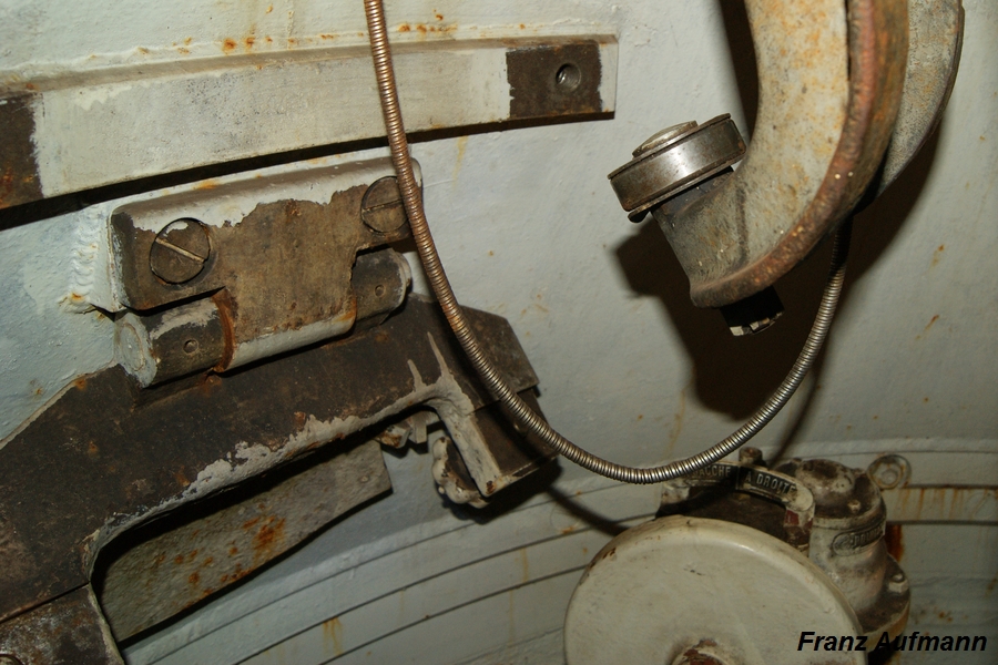
Fot. 14. Korytarz górnej kondygnacji. Na wprost otwór wejściowy do śluzy przeciwgazowej. Po lewej stronie szyb łączący obie kondygnacje. Po prawej wejście do izby dowodzenia.
Fot. 15. Korytarz górnej kondygnacji. Wnęka wewnętrznej strzelnicy obrony wejścia.
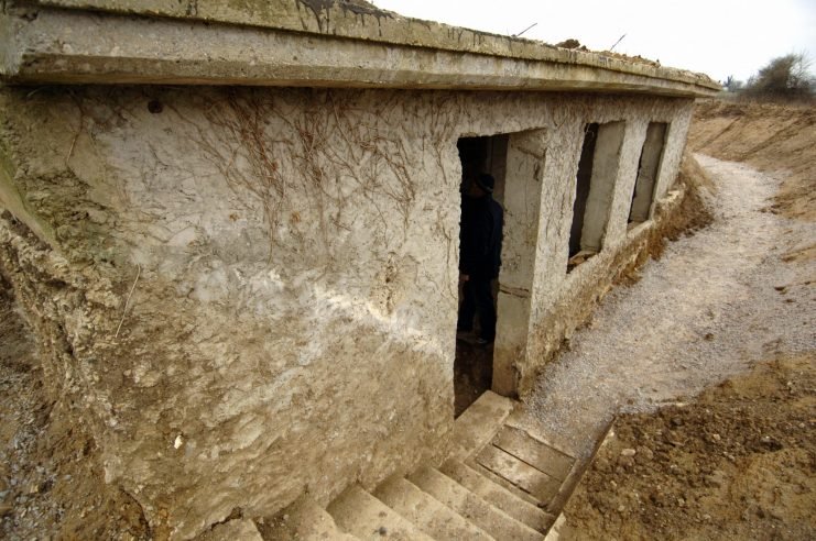
Wejście do schronu znajduje się w tylnej elewacji. Zastosowano standardowe rozwiązanie z załamanym pod kątem 90 stopni korytarzem, zakończonym szczeliną przeciw podmuchową. Wejście do korytarza zabezpieczono drzwiami kratowymi. Do obrony zastosowano jedną strzelnicę wewnętrzną. W bocznych ścianach korytarza umieszczono dwie czerpnie powietrza. Wlot powietrza chroniły dwie płyty stalowe. W stropie między kondygnacjami osadzono pokrywę zamykającą otwór służący do opróżniania szamba. Zbiornik znajdował się poniżej fundamentu schronu. Szyb techniczny do zbiornika z fekaliami zamykała czworokątna gazoszczelna kalpa.
Korytarz górnej kondygnacji


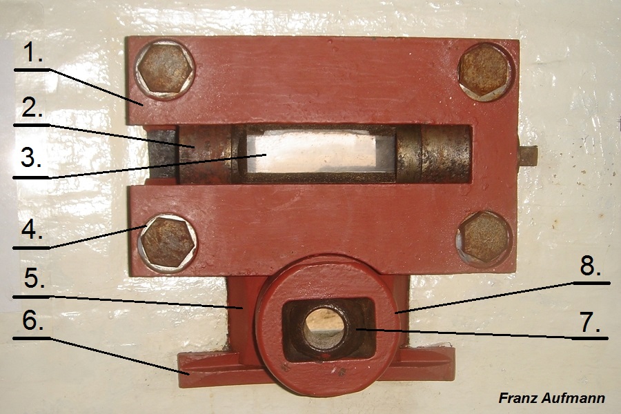
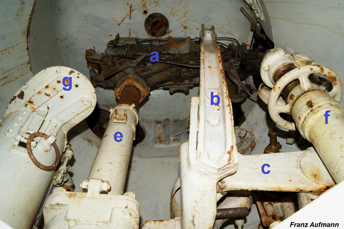
Fot. 14. Widok izby dowodzenia w dwukondygnacyjnym schronie na dwa ckm-y i armatę ppanc. -1. rury łączności głosowej, -2. otwór na antenę, -3. otwór na pancerz peryskopu, -4. rury łączności głosowej, -5. otwór w ścianie do mocowania liny, do montażu lub demontażu armaty ppanc.
Fot. 15. Izba dowodzenia. Częściowo zachowane przewody łączności głosowej.
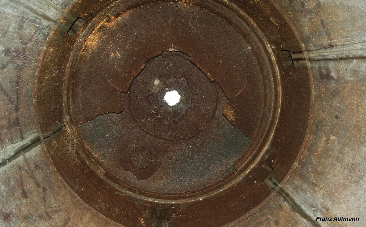
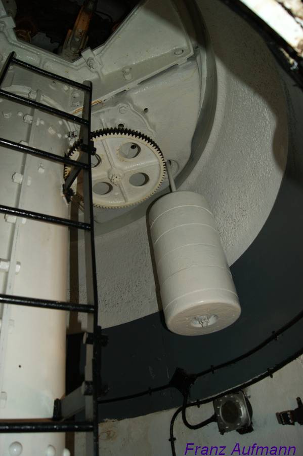
Pomieszczenie zabezpieczało komunikację między izbami bojowymi i kondygnacjami. Do dolnej kondygnacji schodziło się poprzez pionowy szyb z klamrami i poręczami (Fot. 14). Szyb zabezpieczała gazoszczelna klapa z tłoczonej blachy.
Dociskana była do ościeżnicy za pomocą czterech obrotowych rygli. Ościeżnic była konstrukcja spawaną z kątowników 120 x 80, mocowaną do stropu czterema kotwami. Otwór szybu w świetle wynosił 88 cm x 88 cm. Nad szybem, w jego osi zostało umieszczone ogniwo, mocowane do stropu obiektu. Ułatwiało transport wyposażenia do dolnej kondygnacji.
W pomieszczeniu znajdowała się wnęka wewnętrznej strzelnicy obrony wejścia.
Izba dowodzenia
Izba dowodzenia została umieszczona za tylną ścianą centralnej izby bojowej na ckm. W stropie nie osadzono pancerza chroniącego peryskop do prowadzenia obserwacji przez dowódcę schronu. Pozostawiono otwór technologiczny. Nie uwzględniając celowników optycznych na stanowiskach bojowych do nadzoru w sektorach ognia, był to jedyny przyrząd w schronie, umożliwiający prowadzenie okrężnej obserwacji. Dlatego też bardzo istotne znaczenie miała łączność z punktem dowodzenia, sąsiednimi schronami punktu oporu lub obserwatorami na stanowiskach polowych.
W stropie pozostawiono jeszcze jeden otwór. Służył do wysuwania ponad strop schronu anteny do łączności radiowej. W ścianach nie osadzano kompletu wsporników na radiostację i telefon.
W izbie dowodzenia zbiegały się rury łączności głosowej. W przedwojennej polskiej fortyfikacji określane je nazwą telefonu akustycznego. Na Fot. 15 widoczne są pozostałości po trzech rurach służących do komunikacji z izbami bojowymi. W przypadku nie zamontowania rur głosowych pozostawał w ścianie otwór technologiczny o wymiarach 20 cm x 20 cm. W radzieckiej fortyfikacji stałej stosowano rury głosowe bez membran. Po przeciwległej stronie izby znajdują się pozostałości rur głosowych do łączności z izbą załogi i maszynownią. Obie izby znajdowały się w dolnej kondygnacji schronu.
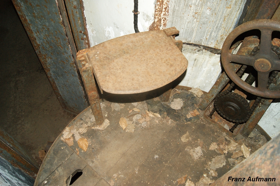
Lewa izba bojowa na ckm


Fot. 16. Widok ściany działowej w lewej izbie na ckm. -a. wsporniki dla górnego zbiornika układu chłodzenia ckm, -b. trzy kotwy dla pompy wodnej, -c. wsporniki pod podstawę z wentylatorem i silnikiem elektrycznym, -d. otwór technologiczny na rurę.
Fot. 17. Widok ściany działowej między izbami z otworem technologicznym na przewód doprowadzające gazy prochowe do wentylatora.
zba bojowa była przeznaczona na 7,62 mm ciężki karabin maszynowy wz. 1910 Maxim (NPS-3). Układ chłodzenia karabinu maszynowego posiadał dwa zbiorniki. Górny zbiornik umieszczano na dwóch wspornikach pod stropem (Fot. 16. -a.) izby. Dolny zbiornik ustawiano na posadzce. Zastosowanie dwóch zbiorników wody nie pozwalało na samoczynny obieg pogrzanej wody, który wykorzystano w układzie chłodzenia z jednym zbiornikiem, stosowanym w polskiej fortyfikacji stałej dla 7,92 mm ckm wz. 30. Do przepompowywania wody pomiędzy zbiornikami służyła pompka, mocowana do ściany trzema kotwami (Fot. 16. -b). W układzie znajdował się zawór odcinający przepływ wody. Umieszczono go po prawej stronie stanowiska NPS-3 w pionowym odcinku stalowej rurki, tuż przed podłączeniem giętkiego przewodu doprowadzającym wodę do chłodnicy ckm.
Na dwóch wspornikach (Fot. 16. -c) montowano wentylator promieniowy KP-4 do usuwania gazów prochowych z 3 izb bojowych. Jako urządzenie został dodatkowo wyposażony w przekładnię mechaniczną z korbą do napędu ręcznego. Wentylator ze skrzynką napędu ręcznego umieszczono na standardowej podstawie. Była to konstrukcja spawana wykonana z kątowników. Pod wentylatorem zamocowano do podstawy silnik elektryczny. Napęd z silnika na wałek wentylatora przekazywany był za pomocą przekładni z paskiem klinowym. W ścianie pozostawiono otwór technologiczny (Fot. 16. -d) na rurę doprowadzającą gazy prochowe do wentylatora (więcej>>
Układ usuwania gazów prochowych w schronach „Linii Mołotowa” (http://hauba.pl/linia-molotowa-rejony-umocnione-na-nowej-zachodniej-granicypanstwowej-zsrr/uklad-usuwania-gazow-prochowych-w-sowieckim-jednokondygnacyjnymschronie- broni-maszynowej-do-ognia-bocznego/)).


.jpg)


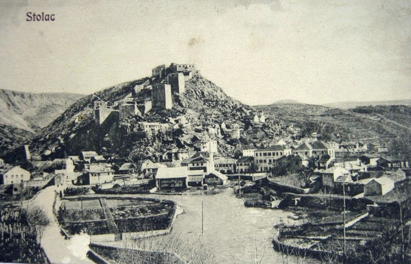
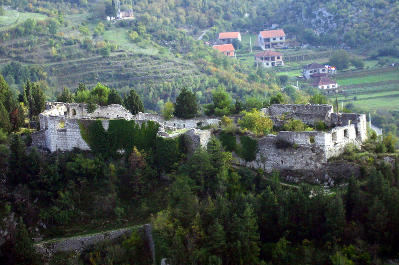 Das
Obere Kastell in Stolac aus der Vogelperspektive. (Foto: Archiv Autor)
Das
Obere Kastell in Stolac aus der Vogelperspektive. (Foto: Archiv Autor)


 An
anderen Orten existierten ebenfalls Forts, jedoch nicht in Form von
Gürtelfestungen. Auch an der zweiten Verteidigungslinie Kalinovik-Ulog
-Nevesinje-Stolac wurden umfangreiche Befestigungsanlagen errichtet.
Zusätzlich wurde in Ostbosnien eine Reihe von Verteidigungsbaracken
gebaut. Die am stärksten befestigten Städte entlang der Drina waren
Goražde, Višegrad, Foca und Zvornik, von denen letztere über die bei
weitem größte Befestigung verfügte.
An
anderen Orten existierten ebenfalls Forts, jedoch nicht in Form von
Gürtelfestungen. Auch an der zweiten Verteidigungslinie Kalinovik-Ulog
-Nevesinje-Stolac wurden umfangreiche Befestigungsanlagen errichtet.
Zusätzlich wurde in Ostbosnien eine Reihe von Verteidigungsbaracken
gebaut. Die am stärksten befestigten Städte entlang der Drina waren
Goražde, Višegrad, Foca und Zvornik, von denen letztere über die bei
weitem größte Befestigung verfügte. 


